August 25, 1841 — Salt Springs

Wednesday, 25th. Remained here all day.

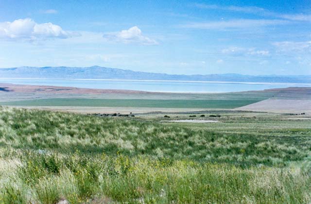
They are camped at Salt Springs, on the northern side of the Great Salt Lake. The water is brackish and barely drinkable, but they stay so that their animals can rest and recuperate. Jimmy John said of this place:

These springs are deep. Some of our horses would have drowned had we not seen them in time. There are also extensive plains here which border on the Lake.”

By the time the Bidwell-Bartleson Party got to the Great Basin, they had been traveling for nearly four months. The last few weeks had been especially hard on the animals, going ten to twenty miles a day. They couldn’t keep up this pace — not on salty water and dry grass. Bidwell and his friends were finding that they had to rest the animals more and more often, and so on the 25th they stayed put, giving the oxen a chance to recuperate. But they couldn’t afford to delay either, so the next day they harnessed up the oxen and got on the trail again.

The picture is of Meadow Hot Springs, near Fillmore, Utah. Not where John Bidwell was at all, but something like I imagine the springs might have looked.

Photo courtesy: topozone.com
Posted in Bidwell-Bartleson Party | Leave a comment

August 24, 1841

Tuesday, 24th.  Cattle strayed this morning to seek water–-late start–-day was warm–-traveled about 10 miles in a W. direction, encamped where we found numerous springs, deep, clear, and somewhat impregnated with salt. The plains were snowy white with salt. Here we procured salt of the best quality. The grass that grew in small spots on the plains was laden with salt which had formed itself on the stalks and blades in lumps, from the size of a pea to that of a hen’s egg. This was the kind we procured, being very white, strong and pure.

Ten miles in a day was good progress under those conditions.  Oxen could pull a wagon at 2 or 3 miles per hour for about 5 hours a day, so 15 miles a day was pretty much the maximum. On a very good day they might make 18 to 20 miles. But these were not good days. The teams were wearing down.

Nicholas “Cheyenne” Dawson later recalled:

We now skirted the north end of the lake, sometimes traveling in a valley and again along the shore of the lake when the mountains jutted down nearer to its shores. In places our wagons would break a crust of salt, like ice in a northern clime. We found water in holes, like wells, but it was all brackish.

Doesn’t sound appealing, does it?

Posted in Bidwell-Bartleson Party | Leave a comment

August 23, 1841 — The Great Salt Lake

Monday, 23rd. Started, bearing our course west, in order to pass the Salt Lake, passed many salt plains and springs in the forenoon. The day was hot. The hills and land bordering on the plains were covered with wild sage. In passing the declivity of a hill, we observed this sage had been plucked up and arranged in long minows, extending near a mile in length. It had been done by the Indians, but for what purpose we could not imagine, unless it was to decoy game. At evening, we arrived in full view of the Salt Lake. Water was very scarce. Cedar grows here, both on the hills and in the valleys. Distance, twenty miles.

“Minows” is probably the printer’s misreading of “windrows,” a long line of raked hay or sheaves of grain laid out to dry.

Bidwell’s first view of Great Salt Lake. Photo by Roy D. Tea
Posted in Bidwell-Bartleson Party | Leave a comment

August 22, 1841

Sunday, 22nd. This morning a man (Mr. Brolaski) returned from the Fort, and said the reason why he came alone was the other men had left him, because he was unable to keep up with them; he having a pack horse laden with provision. He had seen the paper at the intersection of the trails, and was guided by it to the camp; the other were undoubtedly going the rounds of the triangle. Sure enough, they came up in the afternoon, having gone to the river and back; no pilot could be got at the Fort. The families that went into Oregon had disposed of their oxen at the fort and were going to descend the Columbia river with pack horses — they in exchange receive one horse for every ox. Their waggons they could not sell. They procured flour at 50 cents per pint, sugar same price, and other things in proportion. Near where we were camped here were a few hackberry trees.

Henry Brolaski was one of four men who had gone to Fort Hall seeking provisions and a guide. Fort Hall was located near Pocatello, Idaho, about fifty miles northwest of where the two groups parted ways. Built in 1834, Fort Hall served as a trading post on the Snake River for fur tappers, Native Americans, and travelers on the Oregon Trail. The fort was demolished in 1863, but the current replica stands as a memorial to Fort Hall’s heritage. The photos below are from my visit there in 2014.

Upon reaching California, Henry Brolaski spent a few years in Monterey. Before the Gold Rush he went to Peru, where he had a brother. By 1848 he was back in Missouri and planning to go to California, but whether he made or not is unknown. He is considered the first Polish-American to reach California.

Replica of Fort Hall

Hackberry trees bear small, sweet, edible fruit resembling cherries. Any fruit was welcome.

The lack of a pilot was not welcome news. The company badly needed a guide across the Great Basin, but there was none to be had. They were on their own. Cue the ominous music.

Interior of Fort Hall

Posted in Bidwell-Bartleson Party | Leave a comment

August 21, 1841 — Wandering

Saturday, 21st. Marched off in a NW direction, and intersected our trail of Thursday last, having made a complete triangle in the plain. At this intersection of the trails we left a paper elevated by a pole, that the men returning from Fort Hall might shun the tedious rounds we had taken. Found grass and water which answered our purpose very well, though both were salt. Distance ten miles.

Having passed unawares through Cache Valley a few days previously, they reached the point at which the Bear River emptied itself into the Great Salt Lake. Thomas Fitzpatrick had told them to turn west before they reached the lake, in order to find the Humboldt River, so they headed northwest, crossing their tracks in the process.

In the map below you can see the triangle they made at the northeast corner of the Great Salt Lake. For a larger version of this map, go to the National Historic Trails Utah Auto Tour Route map.

Four men had gone to Fort Hall to try to get provisions, and (they hoped) a guide to help them cross the desert. Clearly they could have used a guide.

Posted in Bidwell-Bartleson Party | Leave a comment

August 20, 1841

Friday, 20th. Company remained here while two men went to explore the country. They returned bringing the intelligence that we were within ten miles of where the river disembogued itself into the Great Salt Lake. This was the fruit of having no pilot — we had passed through Cash valley, where we intended to have stopped and did not know it.

“Disembogue” — there’s a word you don’t see every day.

Up until the Parting of the Ways they had had a pilot, Thomas Fitzpatrick, the trail guide hired by Father De Smet. He didn’t work for the Bidwell-Bartleson Party, so they lost his guidance when they split off from the party of missionaries that he was hired to guide into Idaho.

On this map, the green line shows the route of the Bidwell-Bartleson Party. They will skirt the north side of the Great Salt Lake and head west into the desert.

National Historic Trails map of Utah
https://www.nps.gov/cali/planyourvisit/upload/UTAH-ATR-map-final.pdf
Posted in Bidwell-Bartleson Party, Uncategorized | Leave a comment

August 19, 1841 — Heat and Salt

Thursday, 19th. Started early, hoping soon to find fresh water, when we could refresh ourselves and animals, but alas! The sun beamed heavy on our heads as the day advanced, and we could see nothing before us but extensive arid plains, glimmering with heat and salt. At length the plains became so impregnated with salt that vegetation entirely ceased, the ground in many places white as snow with salt & perfectly smooth — the mid-day sun, beaming with uncommon splendor upon these shining plains, made us fancy we could see timber upon the plains, and wherever timber is found there is water always. We marched forward with unremitted pace till we discovered it was an illusion, and lest our teams should give out we returned from S. to E. and hastened to the river which we reached in about 5 miles.

A high mountain overlooked us on the east and the river was thickly bordered with willows — grass plenty but so salt our animals could scarcely eat it; salt glitters upon its blades like frost. Distance 20 miles.

Twenty miles searching for water while the sun beats down and the landscape is a glittering plain of salt. I couldn’t help but think of the old song Cool Water. But which version to link to? Johnny Cash, Marty Robbins, “Buster Scruggs”? Even Tom Jones recorded it. But it has to be The Sons of the Pioneers, as originally recorded in 1941.

Posted in Bidwell-Bartleson Party, Uncategorized | Leave a comment

August 18, 1841

Wednesday, 18th. Traveled but a short distance when we discovered that a deep salt creek prevented our continuing near the river. In ascending this stream in search of a place to cross it, we found on its margin a hot spring, very deep and clear. The day was very warm and we were unable to reach the river; encamped on this salt creek and suffered much for water, the water being so salt we could not drink it. Distance 15 miles.

From Soda Springs and the parting of the ways down the Bear River to the Great Salt Lake is only about 100 miles. On today’s highways this journey would take them a couple of hours. Even at their rate of about 15 miles a day, it might only take them a week to get to Salt Lake, but all this detouring around hills and streams means that they still have several days to go.

Camping on a salt creek is a foretaste, literally, of what they are soon to endure on a regular basis. They are on the banks of the Malad River, so named by earlier fur trappers because the water made them sick (“malade” in French). The banks are steep and the bottom is muddy, making it difficult to cross.

Jimmy John wrote:

18th. This morning we came to a deep muddy creek which we could not cross without going nearly a half a days journey up it and we have travelled about 5 miles. Crossed it and camped on the other bank. There are a number of hot salt springs on the banks of this creek, some are nicely boiling.

In the map below you can see the Malad River on the left, flowing south into the Bear River. The map shows how the party had to proceed up the river to cross, then back down again. The map is from an article tracing the route of the Bidwell-Bartleson Party in Utah, by Roy D. Tea. If you really want to trace this section of the journey, that’s the place to go.

Posted in Bidwell-Bartleson Party, Uncategorized | Leave a comment

August 17, 1841 — Shoshone

Tuesday, 17th. Traveled about 16 miles; saw a large smoke rising out of the mountains before us. It had probably been raised by the Indians, as a telegraph, to warn the tribe that their land was visited by strangers. We were unable to procure any fuel this evening; we therefore slept without fire. The Indians found in this region are Shoshonees; they are friendly.

Indian smoke signals may be a tired trope of old Hollywood westerns, but smoke is a good way to send a simple message over a long distance and Indians did use this method of communication. Smoke signals were used not only by Native Americans of the Plains and Southwest, but also the Chinese, the Greeks, and other ancient cultures.

They are definitely in Shoshone country. The Shoshone tribe was spread across the Great Basin from southern Idaho to northern Utah and from Nevada to eastern Wyoming. At this time (1841) the Shoshone were friendly and peaceful, but increasing white encroachment would result in conflicts in the coming decades.

A Shoshone encampment in the Wind River Mountains of Wyoming, photographed by W. H. Jackson, 1870

Posted in Bidwell-Bartleson Party | Leave a comment

August 16, 1841

Monday, 16th. This morning there was an abundance of water in the little stream and it was running briskly when we left it. If the water was not supplied by the melting of the snow in the mountains, it was really an interesting spring; found an abundance of choke cherries, very large and exquisitely delicious, better than any I ever eat before. Distance traveled, 12 miles.

They had noticed the water in the stream dry up the day before, and then start again during the night. It doesn’t look like Bidwell ever found the answer to this puzzle.

Notice that he says “better than I ever eat before,” rather than ate. He probably pronounced it et, and we now usually pronounce it and spell it ate, although et is still heard in some regions. Compare these present and past tense spellings to read/read. The old spelling of past tense eat can be found in Shakespeare, Boswell, and many other authors.

Chokecherries are best eaten when they are dark red, almost black. To me they look like the berries on pokeweed, a common weed around here, but those are poisonous.

Posted in Bidwell-Bartleson Party, Uncategorized | 1 Comment