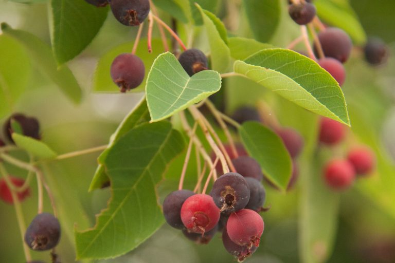
Saturday, 4th. Bought a few serviceberries of the Indians.
I have written about serviceberries before. They would have been a welcome addition, but probably didn’t satisfy the appetites of thirty men, plus a woman and child.
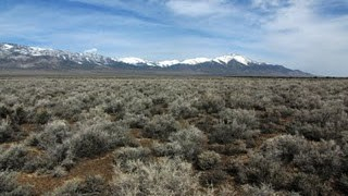
Bidwell would later write that “Provisions were becoming scarce, and we saw that we must avoid unnecessary delay.” Yet they stopped at Tenmile Spring for a week. “The condition of our animals compelled us to rest here,” he wrote. The oxen, mules, and horses were worn down, so it was a good idea to let them recuperate where there was water and grass. But the company could look to the west and see “this desolate region” stretching endlessly ahead of them.
On the other hand, they had to press on and find Mary’s River, so they send two men to scout ahead. Now they were starting to worry that the men had met an untimely end.
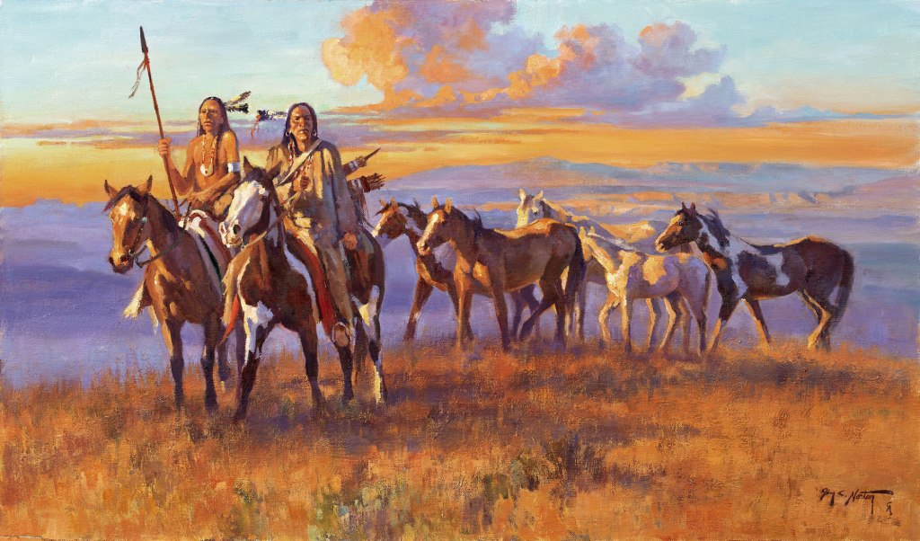
Friday, 3rd. Four or 5 Indians came to camp — bought three horses of them.
The previous Saturday they had gone looking for Indians who would sell them horses, but with no success. Now the Indians have the horses and are ready to trade. The usual payment was in powder and ball.
The local Indians—Shoshones—were happy to trade horses, game, or berries for any useful items, especially ammunition. The travelers were still wary of the Indians, because they never knew whether the natives they encountered would be friendly or not. But once they had established a friendly trading relationship, things went well.
Bidwell doesn’t say that he bought a horse, just that some members of the company bought horses. He may have bought a horse from the Indians at this time. Up until this point he did not have his own horse; he had put all his money into a yoke of oxen and he was on foot. But on September 18th his oxen stray and he goes looking for them on horseback, so either he had bought one, or someone loaned him one.
What does “idle in camp” mean? Maybe a few of the thirty men are out hunting, but they haven’t been having any success with that. The rest are perhaps discussing their situation, repairing harness or wagons, trying not to think about food, and taking naps.
And waiting. Waiting and hoping that their two scouts have found Mary’s River and are on their way back with news. The trouble is, none of them know where the river is. The trappers at Fort Hall told them to go south, and then west, but they don’t know how far in either direction. From where they are now, at Tenmile Spring, the headwaters of Mary’s River (the Humboldt River) are over 100 miles away. They must have been hoping that it was a lot closer than that, but they have no idea.
“Idle in camp”, a drawing by Father Nicholas Point
This is the first time that John Bidwell records killing one of the oxen for meat. It’s another ominous sign — it means that hunting is poor and their other food has run out.
The orange arrow on the map below shows the location of their camp. They are in Utah, and still have to get themselves all the way across Nevada. They should get moving, but they are waiting for Captain Bartleson and Charles Hopper to come back with directions on how to get to Mary’s River.
The green line on this map is the Bidwell-Bartleson Trail. It is not the trail used by any other pioneer companies. The red line to the north and to the south of the Great Salt Lake shows two different California Trail routes.
“No success hunting” is not good. They have probably used up most of the supplies that they brought with them — flour, beans, bacon. They have to live off the land, dependent on the food that they can shoot or catch. And there is not much to find.
Jimmy John didn’t bother to write in his journal during the week that they spend at Tenmile Spring, other than to note that “There is neither rain nor dew here this season of the year. We have had no rain since we left the Platte river.” That’s typical for the American West, but not what they are accustomed to.
Since the company is staying put at the spring, while Bartleson and Hopper scout ahead for Mary’s River, there is not much to report. However, there are some things we can say about our company’s predicament.
A barren, salt-crusted desert extending for some 500 miles was not what they were expecting when they set out from Missouri. Not that they had any knowledge about this unexplored region, but they had been led to believe that there might be large rivers that would carry them from the Rocky Mountains to the Pacific. Many years later, in Echoes of the Past, Bidwell wrote:
Our ignorance of the route was complete. We knew that California lay west, and that was the extent of our knowledge. Some of the maps consulted, supposed of course to be correct, showed a lake in the vicinity of where Salt Lake now is; it was represented as a long lake, three or four hundred miles in extent, narrow and with two outlets, both running into the Pacific Ocean, either apparently larger than the Mississippi River.
Probably this is the map he saw–
This map of North America by Henry Schenck Tanner was first issued in 1822 and reissued with slight revisions (but no changes to the western region) in later years. John Bidwell had seen this map or one like it in Missouri in the winter of 1840-41. It was published in Tanner’s New American Atlas and widely distributed and praised during the 1820s and ’30s. To see the entire map, you can go to the Oregon Encyclopedia. Click on the map image to enlarge.
A close examination of the map shows how little anyone knew about the topography of western America. Look at those rivers! Two large rivers leaving giant Lake Timpanogos and flowing unimpeded to the Pacific Ocean. Another river, the San Buenaventura, flowing from Salt Lake. No wonder some folks told them to take tools for building boats.
You can see from the map that the distance from the Rockies to the Pacific is underestimated, and the Sierra Nevada range is not shown at all. The distance north to south, from the Columbia River to San Francisco Bay (labeled Port Sir Francis Drake) is also much less than it actually is. And even though a number of the Spanish missions are indicated on the map, the coastline of California is all wrong.
At what point did the Bidwell-Bartleson Party realize that there would be no boat ride to California? Did Thomas Fitzpatrick know enough of the region to tell them, or did they have to figure it out for themselves? When some of the men went to Fort Hall looking for a guide, were their expectations of a mighty river laughed at?
In Echoes of the Past Bidwell writes about the information acquired at Fort Hall:
They brought the information that we must strike out west of Salt Lake — as is was even then called by trappers — being careful not to go too far south, lest we should get into waterless country without grass. They also said we must be careful not to go too far north, lest we should get into a broken country and steep canyons, and wander about, as trapping parties had been known to do, and become bewildered and perish.
Sunday 29th. Capt. Bartleson with C. Hopper started to explore the route to the head of Mary’s river, expecting to be absent 8 or 9 days — the Company to await here his return.
All that the Bidwell-Bartleson Party knew about this region was that they had to find Mary’s River. They had been told by Captain Fitzpatrick that Mary’s River, what we now call the Humboldt River, was the only way to cross the Great Basin to the mountains. If the whole group were to go wandering around looking for it, the exploration might be fatal, so they sent off two men on a scouting trip, and the rest stayed where they had water and grass for their animals.
The first non-native explorer to trace and name the river was the Canadian fur trapper Peter Skene Ogden. He had named it Mary’s River after his Native American wife. John C. Fremont was the one who decided to name it after the famous German naturalist Alexander von Humboldt.
John Bartleson had taken the position of captain of the expedition. When he and his friends joined the company he insisted on being made captain, probably feeling that as an older and more experienced man, he was more qualified to lead the group. John Bidwell did not get on well with him. He wrote:
He was not the best man for the position, but we were given to understand that if he was not elected captain, he would not go; and he had seven or eight men with him, and we did not want the party diminished.
Like Bartleson, Charles Hopper was an older man, being about forty at the time. He was an experienced hunter and trapper, and no doubt an asset to the company. He returned East with the Chiles party in 1842, gathered up his family, and returned to California in 1847. He settled on a farm near Napa and lived there until his death in 1880.
Saturday, 28th. Company remained here. A Shoshonee Indian came to our camp; from him we learned that there were more Indians not far off who had horses. Several men and myself went in search of them. Having gone about 5 miles, up hills and down hills covered with thick groves of cedar (red), we unexpectedly came to an Indian, who was in the act of taking care of some meat — venison — which he had just killed; about half of which we readily purchased for 12 cartridges of powder & ball. With him as a pilot we went in pursuit of other Indians; he led us far up in the mountains by a difficult path, where we found two or three families, hid as it were from all the world, by the roughness of nature. The only provision which they seemed to have was a few elderberries and a few seeds; under a temporary covert of bushes, I observed the aged Patriarch, whose head looked as though it had been whitened by the frosts of at least 90 winters. The scars on his arms and legs were almost countless — a higher forehead I never saw upon a man’s head. But here in the solitude of the mountains and with the utmost contentment, he was willing to spend the last days of his life among the hoary rocks and craggy cliffs, where perhaps he, in his youthful gayety, used to sport along crystal streams which run purling from the mountains. Not succeeding in finding horses, we returned to camp.
The Shoshone Indians inhabited present-day northern Utah and southern Idaho, living in small bands of a few hundred at most. Bidwell, as usual, is curious about the Indians, but not disparaging about their way of life.
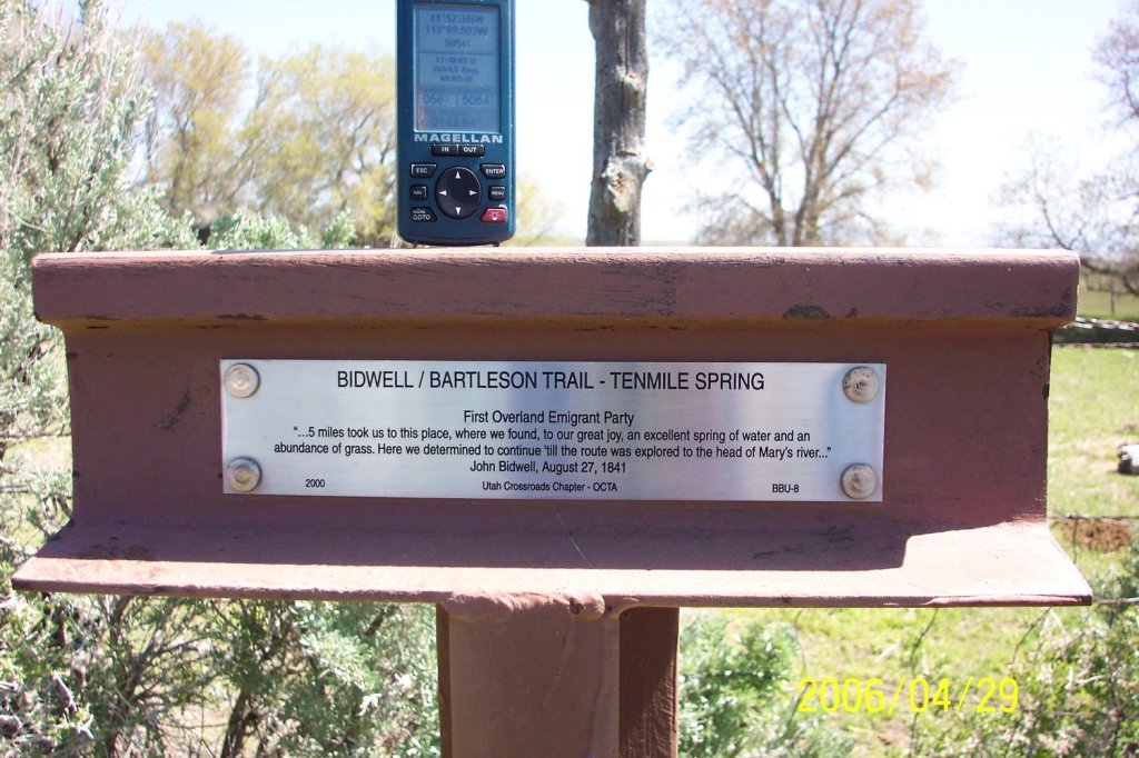
Friday, 27th. Daylight discovered to us a spot of green grass on the declivity of the mountain towards which we were advancing. 5 miles took us to this place, where we found, to our great joy, an excellent spring of water and an abundance of grass. Here we determined to continue ’till the route was explored to the head of Mary’s river and run no more risks of perishing for want of water in this desolate region.
After a 30 mile trek the day before searching for water, well into the night, they awoke to see an oasis only five miles distant. This site is called Tenmile Spring and it was a lifesaver for the Bidwell-Bartleson Company. The view that Bidwell saw as they awoke that morning looked like this (from http://scienceviews.com/bidwell/bidwellaug27.html) —
Declivity in the mountain. 10 mile springs.
Tenmile Spring had plenty of water and grass. They would rest here for the next eight days. Today a trail marker with a quote from Bidwell’s journal marks the site.
Thursday, 26th. Traveled all day over dry barren plains, producing nothing but sage, or rather, as it ought to be called, wormwood, and which I believe will grow without water or soil. Two men were sent ahead to search for water, but returned a little while before dark, unsuccessful.
Our course intersected an Indian trail, which we followed directly north towards the mountains, knowing that in these dry countries the Indian trails always lead to the nearest water. Having traveled till about 10 o’clock p.m. made a halt, and waited until morning. Distance about 30 miles.
This was one of those days when they traveled all day in the hot sun and far into the night, hoping to find fresh water, and saw nothing but sand, salt, and sagebrush. Another day like that might have killed them all. They were wise to follow the Indian trail. It would lead them to water eventually.