Friday, 20th. Company remained here while two men went to explore the country. They returned bringing the intelligence that we were within ten miles of where the river disembogued itself into the Great Salt Lake. This was the fruit of having no pilot — we had passed through Cash valley, where we intended to have stopped and did not know it.
“Disembogue” — there’s a word you don’t see every day.
Up until the Parting of the Ways they had had a pilot, Thomas Fitzpatrick, the trail guide hired by Father De Smet. He didn’t work for the Bidwell-Bartleson Party, so they lost his guidance when they split off from the party of missionaries that he was hired to guide into Idaho.
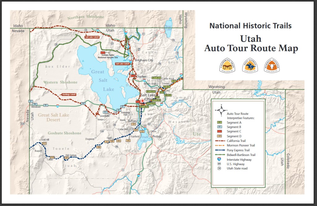
On this map, the green line shows the route of the Bidwell-Bartleson Party. They will skirt the north side of the Great Salt Lake and head west into the desert.
Thursday, 19th. Started early, hoping soon to find fresh water, when we could refresh ourselves and animals, but alas! The sun beamed heavy on our heads as the day advanced, and we could see nothing before us but extensive arid plains, glimmering with heat and salt. At length the plains became so impregnated with salt that vegetation entirely ceased, the ground in many places white as snow with salt & perfectly smooth — the mid-day sun, beaming with uncommon splendor upon these shining plains, made us fancy we could see timber upon the plains, and wherever timber is found there is water always. We marched forward with unremitted pace till we discovered it was an illusion, and lest our teams should give out we returned from S. to E. and hastened to the river which we reached in about 5 miles.
A high mountain overlooked us on the east and the river was thickly bordered with willows — grass plenty but so salt our animals could scarcely eat it; salt glitters upon its blades like frost. Distance 20 miles.
Twenty miles searching for water while the sun beats down and the landscape is a glittering plain of salt. I couldn’t help but think of the old song Cool Water. But which version to link to? Johnny Cash, Marty Robbins, “Buster Scruggs”? Even Tom Jones recorded it. But it has to be The Sons of the Pioneers, as originally recorded in 1941.
Wednesday, 18th. Traveled but a short distance when we discovered that a deep salt creek prevented our continuing near the river. In ascending this stream in search of a place to cross it, we found on its margin a hot spring, very deep and clear. The day was very warm and we were unable to reach the river; encamped on this salt creek and suffered much for water, the water being so salt we could not drink it. Distance 15 miles.
From Soda Springs and the parting of the ways down the Bear River to the Great Salt Lake is only about 100 miles. On today’s highways this journey would take them a couple of hours. Even at their rate of about 15 miles a day, it might only take them a week to get to Salt Lake, but all this detouring around hills and streams means that they still have several days to go.
Camping on a salt creek is a foretaste, literally, of what they are soon to endure on a regular basis. They are on the banks of the Malad River, so named by earlier fur trappers because the water made them sick (“malade” in French). The banks are steep and the bottom is muddy, making it difficult to cross.
Jimmy John wrote:
18th. This morning we came to a deep muddy creek which we could not cross without going nearly a half a days journey up it and we have travelled about 5 miles. Crossed it and camped on the other bank. There are a number of hot salt springs on the banks of this creek, some are nicely boiling.
In the map below you can see the Malad River on the left, flowing south into the Bear River. The map shows how the party had to proceed up the river to cross, then back down again. The map is from an article tracing the route of the Bidwell-Bartleson Party in Utah, by Roy D. Tea. If you really want to trace this section of the journey, that’s the place to go.
Tuesday, 17th. Traveled about 16 miles; saw a large smoke rising out of the mountains before us. It had probably been raised by the Indians, as a telegraph, to warn the tribe that their land was visited by strangers. We were unable to procure any fuel this evening; we therefore slept without fire. The Indians found in this region are Shoshonees; they are friendly.
Indian smoke signals may be a tired trope of old Hollywood westerns, but smoke is a good way to send a simple message over a long distance and Indians did use this method of communication. Smoke signals were used not only by Native Americans of the Plains and Southwest, but also the Chinese, the Greeks, and other ancient cultures.
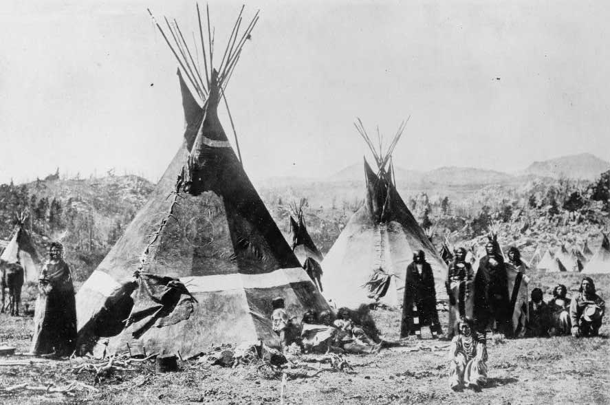
They are definitely in Shoshone country. The Shoshone tribe was spread across the Great Basin from southern Idaho to northern Utah and from Nevada to eastern Wyoming. At this time (1841) the Shoshone were friendly and peaceful, but increasing white encroachment would result in conflicts in the coming decades.
A Shoshone encampment in the Wind River Mountains of Wyoming, photographed by W. H. Jackson, 1870
Monday, 16th. This morning there was an abundance of water in the little stream and it was running briskly when we left it. If the water was not supplied by the melting of the snow in the mountains, it was really an interesting spring; found an abundance of choke cherries, very large and exquisitely delicious, better than any I ever eat before. Distance traveled, 12 miles.
They had noticed the water in the stream dry up the day before, and then start again during the night. It doesn’t look like Bidwell ever found the answer to this puzzle.
Notice that he says “better than I ever eat before,” rather than ate. He probably pronounced it et, and we now usually pronounce it and spell it ate, although et is still heard in some regions. Compare these present and past tense spellings to read/read. The old spelling of past tense eat can be found in Shakespeare, Boswell, and many other authors.
Chokecherries are best eaten when they are dark red, almost black. To me they look like the berries on pokeweed, a common weed around here, but those are poisonous.
Sunday, 15th. Continued our journey over hills and ravines, going to almost every point of the compass in order to pass them. The day was very warm — the grass had been very good, but it was now very much parched up. Having come about 15 miles, we encamped on a small stream proceeding out of the mountains at no great distance from us. But we were surprised to see it become perfectly dry in the course of an hour; some of the guard said there was plenty of water in it about midnight.
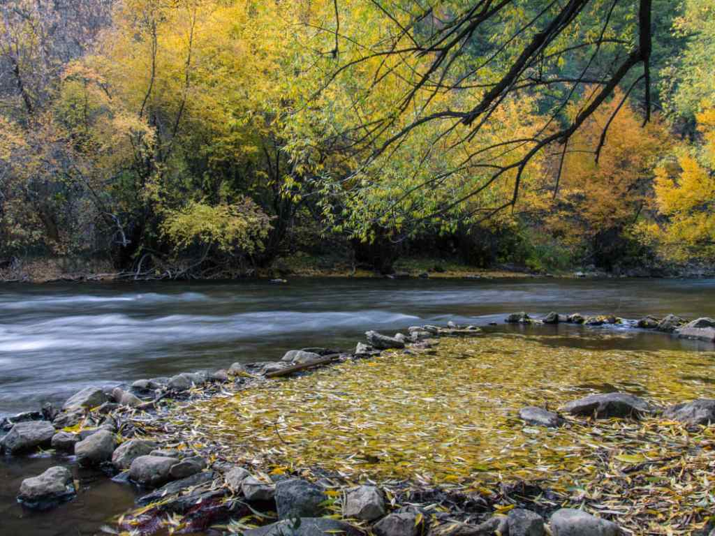
I don’t know exactly where they were along the Bear River, but here is a nice picture of Logan Canyon in Cache Valley, Utah.
Saturday, 14th. Left the river on account of the hills which obstructed our way on it; found an abundance of choke cherries, many of which were ripe. Road uncommonly broken, did not reach the river, distance about 14 miles.
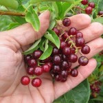
Chokecherries (Prunus virginiana) are a small dark red fruit, native across most of North America and related to cherries and plums. They are chockful of antioxidants. They have a slightly astringent taste, but are sweet and delicious when fully ripe (so I am told — I’ve never eaten them).
For Native Americans, chokecherries were an important part of their diet and a key ingredient in pemmican. For the emigrants, chokecherries were a welcome addition to their otherwise monotonous fare. At this point in their journey, in mid-August, is when chokecherries ripen and are ready to pick.
Friday, 13th. Traveled about 10 miles in a southerly direction. It was the intention of the company to stop and hunt in Cash valley, which is on Bear river 3 or 4 days’ travel from its mouth.
He means Cache Valley, in northern Utah. Captain Fitzpatrick would have mentioned it as a good place to rest and hunt.
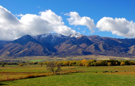
Cache Valley was well known to the fur trappers of the early 19th century. It was sometimes the site of rendezvous and was considered a good place to “cache” your furs until it was time to take the lot back to Missouri for sale. It is a beautiful well-watered fertile valley between the Rockies and the ranges of the Great Basin.
Today the Cache Valley is a well-populated area, with a major city (Logan) and lots of farms.
The Cache Valley and the Wellsville Mountains. Photo uploaded to Pinterest by Annie M.
But the Company is not there yet. They still have several days of travel down a river hemmed in by hills before they get to the valley. And on the 13th, Jimmy John said:
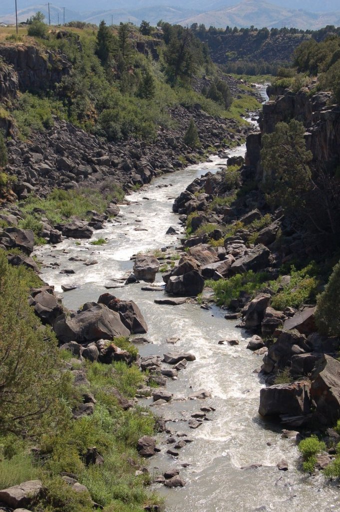
The river here runs thru a deep channel of black rock which has the appearance of being melted by volcanic eruptions and not by earthquakes.
They were probably trying to get through Black Canyon. It is now a popular place for kayaking.
I, in company with another man (J. John), went some distance below the camp to fish in the river; fished sometime without success-–concluded we could spend the afternoon more agreeably. The day was uncomfortably warm, could find no place to shelter us from the burning sun, except the thick copses of willows–these we did not like to enter on account of the danger of falling in with bears. We concluded to ascend the mountain, where were two spots of snow in full view, in order to enjoy the contrast between a scorching valley and a snowy mountain. Supposed the snow not more than 4 miles distant; set out without our guns knowing they would be a hindrance in ascending the mountain.
Our march was unremitted for at last 4 miles, had only gained the side of a hill which we at first supposed not more than a mile off; here we lingered to observe several kinds of trees which we had not before observed, among which were a kind of rock maple, choke cherry, &c. But conscious of being defeated in our object, if we lost much time, we ran up the eminence with renewed vigor, till at last gained the summit. But, being determined not to be outdone, we continued on under all the strength we could command. Crossed a valley 3/4 of a mile wide, ascended craggy steeps and passed through thickets of the densest kind; night obscured the valley below us, lost sight of the snow above us, afraid to return lest we fall in with bears as their signs were plenty and fresh; continued to ascend the mountain till midnight could not find the snow — we were cloud, not having our coats. Clouds drifted against the mountain and made us wet — slept under a pine tree which afforded us good shelter.
Morning came, it found us about half a mile below the snow, took as much as we could conveniently carry; took another route down the mountain, running and jumping as fast as our strength would permit, arrived at the camp about noon. They supposed, without a doubt, that the Blackfeet had got us, had been up all night on guard, every fire had been put out, they had been out twice in search of us and were about to start again when we arrived. We were received with a mixture of joy and reprehension. The company was soon under way and traveled about 4 miles.
James John, always known as Jimmy John, was from Ohio and ten years older than Bidwell. He would later settle in Oregon and found the town of St. Johns on the Willamette, now a neighborhood in Portland.
Bidwell told this story every time that he told about the trip; it was a major feature in all his accounts. In his 1877 dictation for H.H. Bancroft, he describes their route down the mountain:
At first the way was smooth and easy but soon we were sliding down in the snow and mud with our buckskin suits wet and bedraggled. This way soon led into a most rugged canyon and thickets so dense that it became impossible to pass through them except in the trails of the grizzly bears. . . . We carried our sheath knives in our hands at every step, for we knew not at what instant we would meet a bear face-to-face.
In The First Emigrant Train to California he describes their reception when they returned on the 12th:
Their first questions were “Where have you been?” “Where have you been?” I was able to answer triumphantly, “We have been up to the snow!” and to demonstrate the fact by showing all the snow I had left, which was now reduced to a ball about the size of my fist.
He was lucky that someone didn’t beat him over the head with that chunk of ice. One man suggested that they ought to be horsewhipped. “We laid hold of our rifles at once and told him neither he nor anyone else should apply such language to us.”
Wednesday, 11th. Having traveled about 6 miles this morning the Company came to a halt — The Oregon company was now going to leave Bear river for Ft. Hall, which is situated on Lewis river, a branch of the Columbia. Many who purposed in setting out to go immediately through to California, here concluded to go into Oregon so that the California company now consisted of only 32 men and one woman and child, there being but one family.
Fort Hall is on the Snake River, which is indeed a tributary of the Columbia, but I think Bidwell thought they were closer to Oregon and California than they really were.
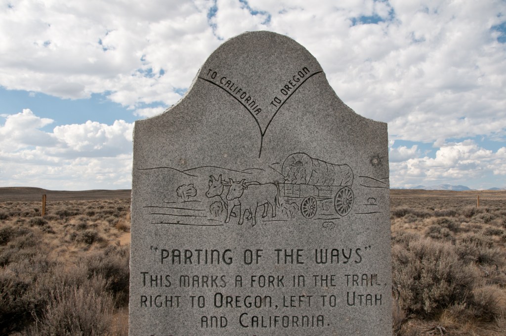
Monument along HW 28 designating the location of the “parting of the ways’ for those emigrants who chose to take the Seminole Cutoff. This monument, however is now believed to be a substantial distance from the true ‘Parting of the Ways. Along HW 28 Wyoming.
The two companies, after bidding each other a parting farewell, started and were soon out of sight. Several of our Company, however, went to Ft. Hall to procure provision, and to hire if possible a pilot to conduct us to the Gap in the California mountains, or at least to the head of Mary’s river. We were therefore to move slowly ’till their return. Encamped on Bear river, having come about 12 miles.
The Gap in the California mountains! If only there were, how much easier the journey would be for them and all the later pioneers. In a later writing, The First Emigrant Train to California, Bidwell writes:
Thirty-two of our party, becoming discouraged, decided not to venture without path or guide into the unknown and trackless region towards California, but concluded to go with the missionary party to Fort Hall and thence to find their way down Snake and Columbia rivers into Oregon. The rest of us — also thirty-two in number, including Benjamin Kelsey, his wife and little daughter — remained firm, refusing to be diverted from our original purpose of going direct to California. After getting all the information we could from Captain Fitzpatrick, we regretfully bade good-by to our fellow emigrants and to Father De Smet and his party.
And so they ventured into the unknown, and into the very worst part of the journey. But first, John Bidwell and his friend James John are going to have an adventure.