Sunday, 15th. Continued our journey over hills and ravines, going to almost every point of the compass in order to pass them. The day was very warm — the grass had been very good, but it was now very much parched up. Having come about 15 miles, we encamped on a small stream proceeding out of the mountains at no great distance from us. But we were surprised to see it become perfectly dry in the course of an hour; some of the guard said there was plenty of water in it about midnight.
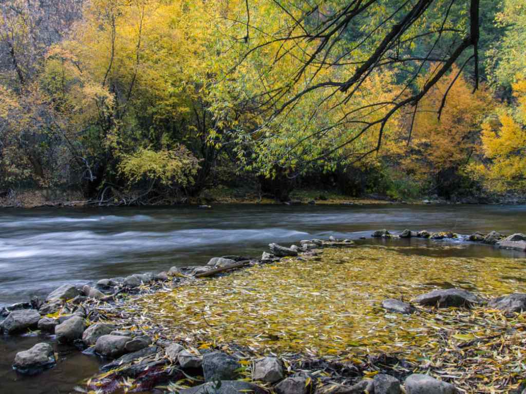
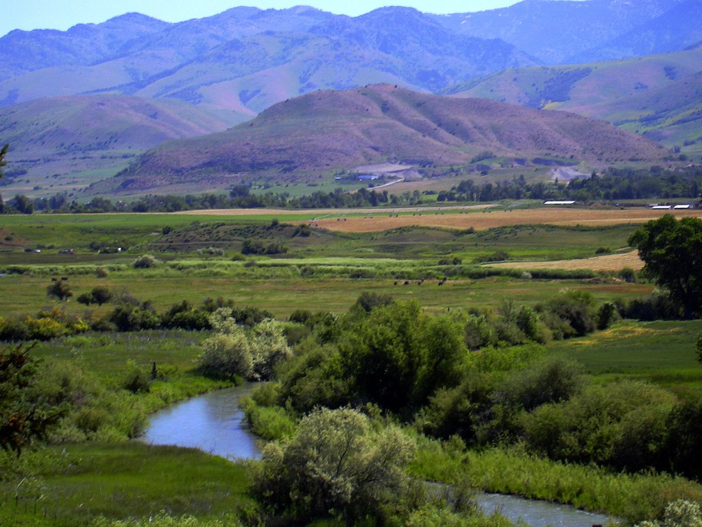
I don’t know exactly where they were along the Bear River, but here is a nice picture of Logan Canyon in Cache Valley, Utah.
Saturday, 14th. Left the river on account of the hills which obstructed our way on it; found an abundance of choke cherries, many of which were ripe. Road uncommonly broken, did not reach the river, distance about 14 miles.
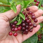
Chokecherries (Prunus virginiana) are a small dark red fruit, native across most of North America and related to cherries and plums. They are chockful of antioxidants. They have a slightly astringent taste, but are sweet and delicious when fully ripe (so I am told — I’ve never eaten them).
For Native Americans, chokecherries were an important part of their diet and a key ingredient in pemmican. For the emigrants, chokecherries were a welcome addition to their otherwise monotonous fare. At this point in their journey, in mid-August, is when chokecherries ripen and are ready to pick.
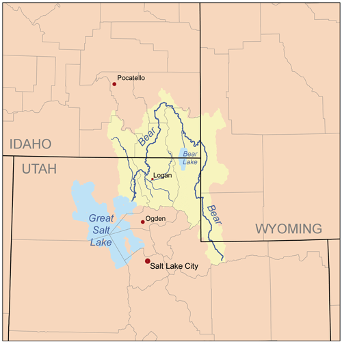
Friday, 13th. Traveled about 10 miles in a southerly direction. It was the intention of the company to stop and hunt in Cash valley, which is on Bear river 3 or 4 days’ travel from its mouth.
He means Cache Valley, in northern Utah. Captain Fitzpatrick would have mentioned it as a good place to rest and hunt.
Cache Valley was well known to the fur trappers of the early 19th century. It was sometimes the site of rendezvous and was considered a good place to “cache” your furs until it was time to take the lot back to Missouri for sale. It is a beautiful well-watered fertile valley between the Rockies and the ranges of the Great Basin.
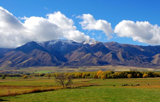
Today the Cache Valley is a well-populated area, with a major city (Logan) and lots of farms.
The Cache Valley and the Wellsville Mountains. Photo uploaded to Pinterest by Annie M.
But the Company is not there yet. They still have several days of travel down a river hemmed in by hills before they get to the valley. And on the 13th, Jimmy John said:
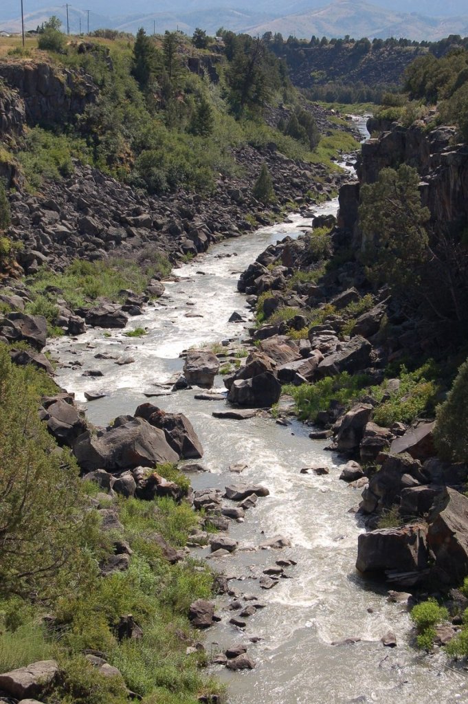
The river here runs thru a deep channel of black rock which has the appearance of being melted by volcanic eruptions and not by earthquakes.
They were probably trying to get through Black Canyon. It is now a popular place for kayaking.
I, in company with another man (J. John), went some distance below the camp to fish in the river; fished sometime without success-–concluded we could spend the afternoon more agreeably. The day was uncomfortably warm, could find no place to shelter us from the burning sun, except the thick copses of willows–these we did not like to enter on account of the danger of falling in with bears. We concluded to ascend the mountain, where were two spots of snow in full view, in order to enjoy the contrast between a scorching valley and a snowy mountain. Supposed the snow not more than 4 miles distant; set out without our guns knowing they would be a hindrance in ascending the mountain.
Our march was unremitted for at last 4 miles, had only gained the side of a hill which we at first supposed not more than a mile off; here we lingered to observe several kinds of trees which we had not before observed, among which were a kind of rock maple, choke cherry, &c. But conscious of being defeated in our object, if we lost much time, we ran up the eminence with renewed vigor, till at last gained the summit. But, being determined not to be outdone, we continued on under all the strength we could command. Crossed a valley 3/4 of a mile wide, ascended craggy steeps and passed through thickets of the densest kind; night obscured the valley below us, lost sight of the snow above us, afraid to return lest we fall in with bears as their signs were plenty and fresh; continued to ascend the mountain till midnight could not find the snow — we were cloud, not having our coats. Clouds drifted against the mountain and made us wet — slept under a pine tree which afforded us good shelter.
Morning came, it found us about half a mile below the snow, took as much as we could conveniently carry; took another route down the mountain, running and jumping as fast as our strength would permit, arrived at the camp about noon. They supposed, without a doubt, that the Blackfeet had got us, had been up all night on guard, every fire had been put out, they had been out twice in search of us and were about to start again when we arrived. We were received with a mixture of joy and reprehension. The company was soon under way and traveled about 4 miles.
James John, always known as Jimmy John, was from Ohio and ten years older than Bidwell. He would later settle in Oregon and found the town of St. Johns on the Willamette, now a neighborhood in Portland.
Bidwell told this story every time that he told about the trip; it was a major feature in all his accounts. In his 1877 dictation for H.H. Bancroft, he describes their route down the mountain:
At first the way was smooth and easy but soon we were sliding down in the snow and mud with our buckskin suits wet and bedraggled. This way soon led into a most rugged canyon and thickets so dense that it became impossible to pass through them except in the trails of the grizzly bears. . . . We carried our sheath knives in our hands at every step, for we knew not at what instant we would meet a bear face-to-face.
In The First Emigrant Train to California he describes their reception when they returned on the 12th:
Their first questions were “Where have you been?” “Where have you been?” I was able to answer triumphantly, “We have been up to the snow!” and to demonstrate the fact by showing all the snow I had left, which was now reduced to a ball about the size of my fist.
He was lucky that someone didn’t beat him over the head with that chunk of ice. One man suggested that they ought to be horsewhipped. “We laid hold of our rifles at once and told him neither he nor anyone else should apply such language to us.”
Wednesday, 11th. Having traveled about 6 miles this morning the Company came to a halt — The Oregon company was now going to leave Bear river for Ft. Hall, which is situated on Lewis river, a branch of the Columbia. Many who purposed in setting out to go immediately through to California, here concluded to go into Oregon so that the California company now consisted of only 32 men and one woman and child, there being but one family.
Fort Hall is on the Snake River, which is indeed a tributary of the Columbia, but I think Bidwell thought they were closer to Oregon and California than they really were.
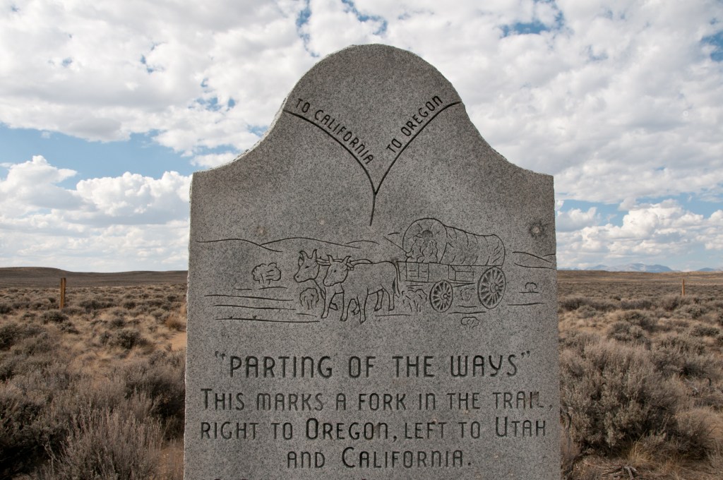
Monument along HW 28 designating the location of the “parting of the ways’ for those emigrants who chose to take the Seminole Cutoff. This monument, however is now believed to be a substantial distance from the true ‘Parting of the Ways. Along HW 28 Wyoming.
The two companies, after bidding each other a parting farewell, started and were soon out of sight. Several of our Company, however, went to Ft. Hall to procure provision, and to hire if possible a pilot to conduct us to the Gap in the California mountains, or at least to the head of Mary’s river. We were therefore to move slowly ’till their return. Encamped on Bear river, having come about 12 miles.
The Gap in the California mountains! If only there were, how much easier the journey would be for them and all the later pioneers. In a later writing, The First Emigrant Train to California, Bidwell writes:
Thirty-two of our party, becoming discouraged, decided not to venture without path or guide into the unknown and trackless region towards California, but concluded to go with the missionary party to Fort Hall and thence to find their way down Snake and Columbia rivers into Oregon. The rest of us — also thirty-two in number, including Benjamin Kelsey, his wife and little daughter — remained firm, refusing to be diverted from our original purpose of going direct to California. After getting all the information we could from Captain Fitzpatrick, we regretfully bade good-by to our fellow emigrants and to Father De Smet and his party.
And so they ventured into the unknown, and into the very worst part of the journey. But first, John Bidwell and his friend James John are going to have an adventure.
Tuesday, 10th. The day was fine and pleasant; a soft and cheerful breeze and the sky bedimmed by smoke brought to mind the tranquil season of autumn. A distance of 10 miles took us to the Soda Fountain, where we stopped the remainder of the day. This is a noted place place in the mountains and is considered a great curiosity–within the circumference of 3 or 4 miles there are included no less than 100 springs, some bursting out on top of the ground, others along the banks of the river which are very low at this place, and some even in the bottom of the river.
The water is strongly impregnated with soda, and wherever it gushes out of the ground, a sediment is deposited, of a reddish color, which petrifies and forms around the springs large mounds of porous rock; some of which are no less than fifty feet high. Some of these fountains have become entirely dry, in consequence of the column of water which they contained becoming so high as to create sufficient power by its pressure to force the water to the surface in another place.
In several of the springs the water is lukewarm — but none were very cold. The ground was very dry at this time, and made a noise as we passed over it with horses, as though it was hollow underneath. Cedar grows here in abundance, and the scenery of the country is romantic. Father De Smet, with 2 or 3 Flathead Indians, started about dark in the evening to go to Fort Hall, which was 50 miles distant.
It sounds like Yellowstone National Park, or Bumpass Hell in Lassen Volcanic National Park.
Bumpass Hell, July 2020
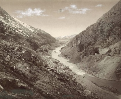
The Soda Fountain, or Soda Springs, was a well-known landmark on the Oregon Trail, and many travelers got out their diaries and recorded their impressions. It’s difficult to find any photos from the 19th century though. Here is one, taken by W.H. Jackson in 1872, of extinct basins at Soda Springs.
Library of Congress
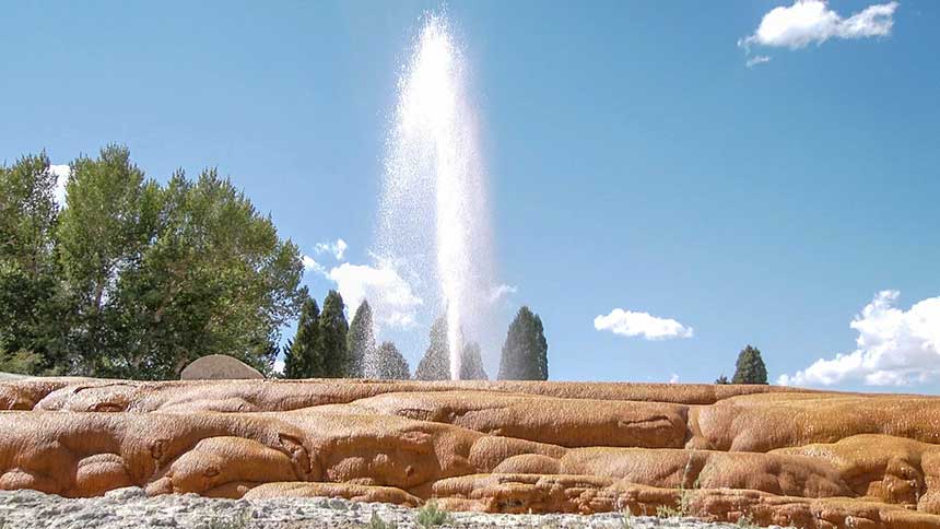
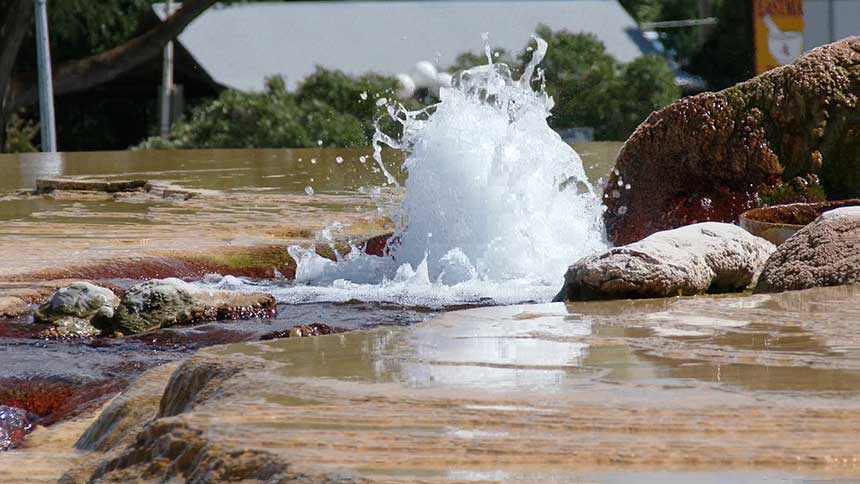
Today the landscape has changed greatly at Soda Springs, Idaho. Most of the naturally carbonated springs are gone, covered by a man-made reservoir. The main attraction is a geyser, the only “captive” geyser in the country, which was created in 1837 when a well drilling operation, which was attempting to build a natural hot springs swimming pool, inadvertently released a tepid geyser that shot 100 feet into the air. The geyser now has a timer on it and is released once an hour.
Mike Price, EastIdahoNews.com The geyser John Bidwell didn’t get to see
Let’s hope they all took baths here. I’ll bet they needed them.
9th. Traveled 16 miles on the bank of the river except in the afternoon we left the river and returned to it at night and camped. Killed two antelope and caught a number of fine fish.
Note the difference in mileage, which suggests that they were estimating it.
Sunday, 8th. Started about noon and went ten miles; scenery grand.
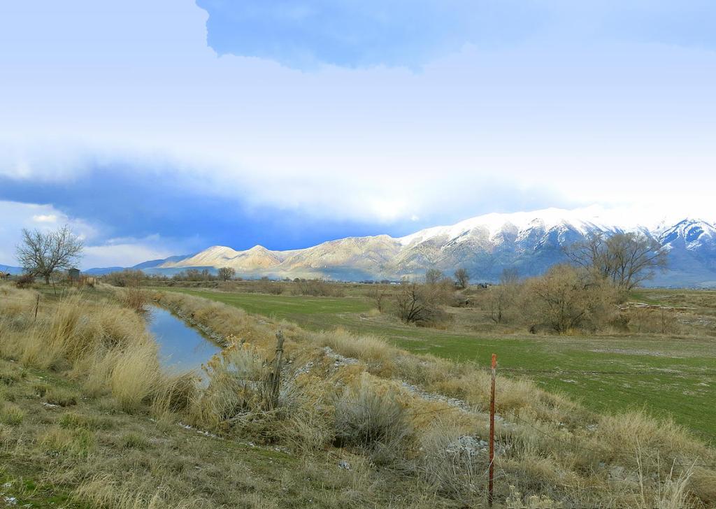
I have never traveled through the Bear River Valley, so I don’t have any pictures of my own. But here are a few gathered from around the web to give you an idea of the grand scenery that John Bidwell was enjoying.
The hills often came right down to the banks of the river, making travel along the river impossible. (See the last photo of Black Canyon.) The company would have to detour inland and around the hills, then back to the river. Jimmy John noted one such detour on the 7th:
Left the river this morning and came to it at twelve. Nooned there and left it again on account of the hills next to the river. Came to it at night and camped on its bank.
Imagine trying to get an ox-drawn wagon through the hills and back down to the river.
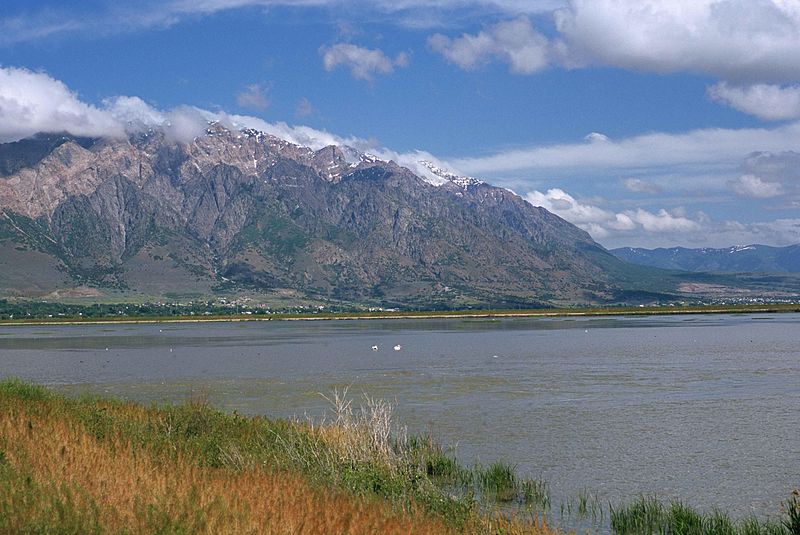
John Bidwell waxes poetical in the Bear River Valley:
Saturday, 7th. This morning we were obliged to make an inland circuit from the river, the bluffs approaching so near the river as to rend it impossible to continue along its banks. We, however, reached it again by a most beautiful defile, and beautifully watered by a small rivulet proceeding from a spring. In the afternoon we again left the river on account of the hills, and did not reach it again until dark. The bluffs were exceedingly high, and no person could ever believe that wagons ever passed these huge eminences of nature, did he not witness it with his own eyes. But the pleasing view we had from their top, just as the sun was going to sleep behind the western mountains, paid us for all our trouble.
A most beautiful landscape presented itself to view — the rugged summits of almost every shape were fantastically pictured upon the sky bounding the western horizon. A beautiful little lake was seen to the south, whose surface was fancifully mottled with numerous islands, while the river meandered proudly through the valley among willows and scattering cottonwoods till it disappeared among the hills in the shades of evening. Distance traveled today 16 miles.
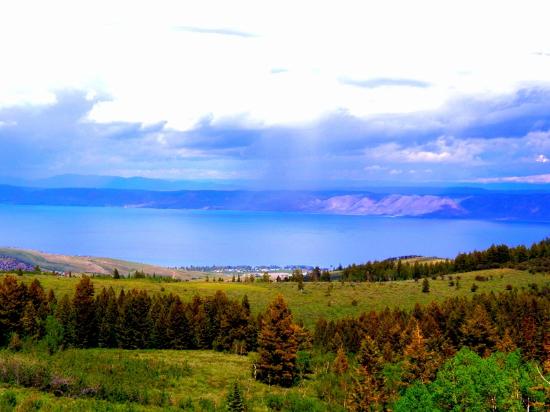
Over and over, Bidwell uses the word “beautiful” — what a refreshing sight that landscape must have been. After traveling across the arid landscape of western Wyoming, the Bear River valley was an oasis of good water, plentiful grass, and abundant game. The “beautiful little lake” which they could see to the south must have been Bear Lake, which gives us a pretty good idea of where they were on August 7th.
This photo of Bear Lake State Park is courtesy of Tripadvisor.
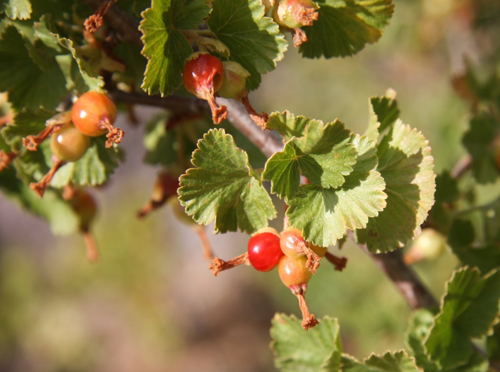
Friday, 6th. Had a fine road down the valley of the Bear river and made about 25 miles during the day. Found many kinds of wild currants, red, black, yellow, &c., some of which were of excellent quality.
John Bidwell has mentioned finding currants before. On July 26 we talked about black currants (Ribes nigrum). Another related berry found in the Rocky Mountains is wax currant (Ribes cereum) which is very small and red.
All these berries would be a welcome addition to the pioneer diet. They can be eaten raw straight from the bush or cooked into oatmeal or stew. Being high in vitamin C and other nutrients, they help prevent scurvy, a common ailment on the trail.