July 6, 1841 — Independence Rock and Devil’s Gate

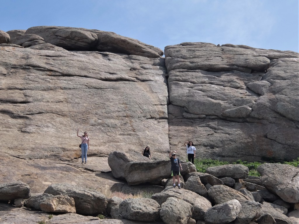
Tuesday, 6th. This morning John Gray and Romaine were sent on to Green River to see if there were any trappers at the rendezvous, and then return to the company with the intelligence. All hands were anxious to have their names inscribed on this memorable rock, so that we did not start until near noon, went up stream about 8 miles and encamped on Sweet Water.

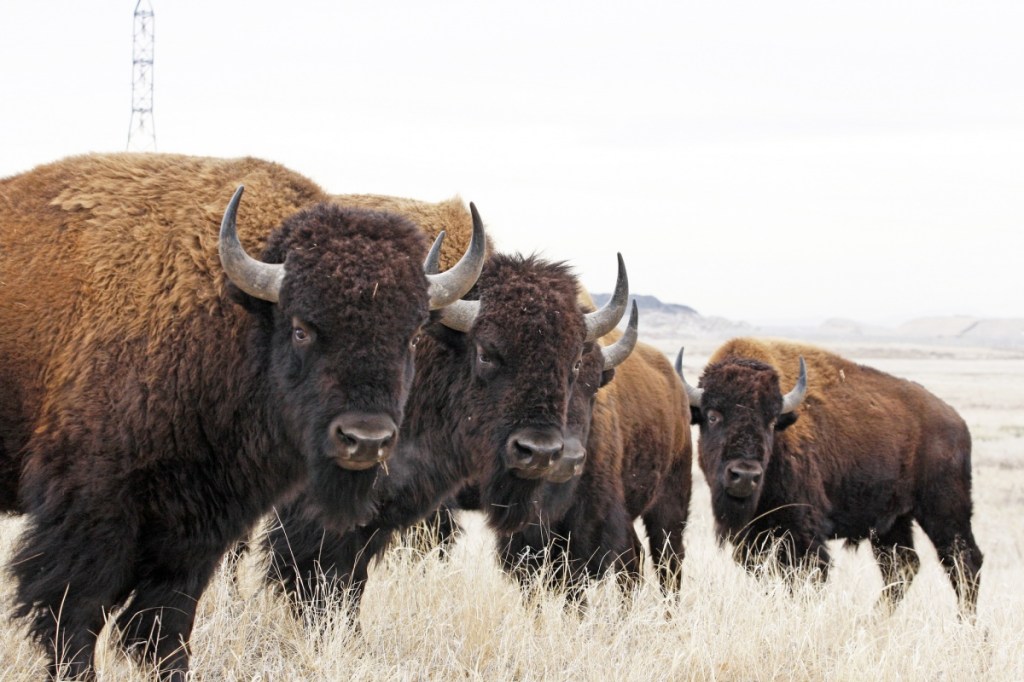
John Gray (usually spelled Grey) was a fur trader with many years experience in the mountains, hired by the the missionaries as a hunter for their group. W. G. Romaine, an Englishman, had also hired Gray as his guide in the American West. Gray would already be familiar with the trail to the Green River rendezvous, which is why he was sent off by Captain Fitzpatrick to see if any mountain men were gathered there. July was the month for rendezvous.

Upper Green River Rendezvous Site

According to the Wikipedia entry for the Upper Green River Rendezvous Site, a National Historic Landmark:

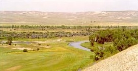
The rendezvous was an organized meeting point for fur trappers, their suppliers, and the buyers of their products to meet. The meetings were first organized by William Henry Ashley, and brought a sense of organization and structure to the otherwise dispersed fur trapping and trading business. Meetings were held annually, generally centered at some location on the Green River. Five were known to be held near the confluence with Horse Creek, but all of them were sprawling affairs, due to the large number of animals needing water and forage.

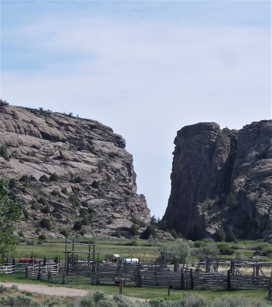
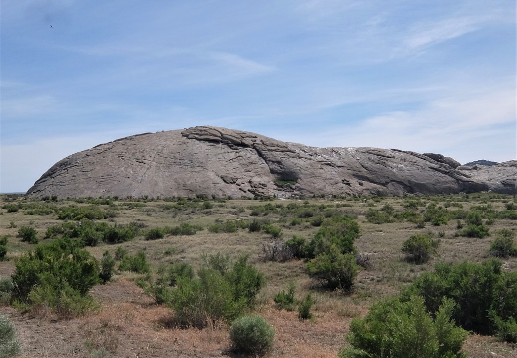
Bidwell in his journal entry does not mention nearby Devil’s Gate, but James John did, though he calls it “cut rock” rather than its current name of Devil’s Gate.

6th. Started at the usual hour travelling up Sweet water valley. Passed by the curiosity in the mountains called cut rock having a gap about 60 feet wide not less than 250 feet high thru which passes the Sweet water creek.

Devil’s Gate today, from the south side
Posted in Bidwell-Bartleson Party, Uncategorized | Leave a comment

How Did Pioneers Measure Mileage?

Several times people have asked me, “How did John Bidwell know how far they had traveled each day? How did they measure the miles?” It’s a good question and I can only guess at the answer, but here goes—

Attempts to measure distance traveled go back a long way. The ancient Romans did it. So did the Chinese. A simple way to measure distance is to tie a rag or ribbon to a wheel and have somebody count the number of revolutions. Multiply that by the circumference of the wheel and you have the distance traveled.

That is not a job I would want, but Julius Caesar would have made a soldier or a slave do the counting.

Benjamin Franklin (of course! who else?) invented an odometer when he was postmaster general in order to calculate the distance between major cities. According to How Stuff Works, it was a geared device that clicked over a mile for every 400 revolutions of the wheel of his carriage. The Franklin Institute has such an odometer in its collection.

An odometer similar to Franklin’s, from the Franklin Institute.

William Clayton, a convert to the Church of Jesus Christ of Latter-Day Saints and a Mormon pioneer, developed an improved odometer, which he called a roadometer, in 1847. According the the National Park Service,

Just 10 days and 75 miles out of Winter Quarters, William Clayton recorded in his journal: I walked this afternoon in company with Orson Pratt and suggested to him the idea of fixing a set of wooden cog wheels to the hub of a wagon wheel in such order as to tell the exact number of miles we travel each day. He seemed to agree with me that it could be easily done at a trifling expense. In this fashion the odometer, called the roadometer, was invented in 1847 by the Mormon pioneers crossing the plains from Missouri.

The National Park service article on Clayton’s odometer has a diagram, in case you want to build your own. The use of this device enabled Clayton to give accurate information to future emigrants in his The Latter-day Saints’ Emigrants’ Guide.

Clayton’s odometer

But Clayton made his device in 1847, and Bidwell was on the trail in 1841. Did he and his companions have some kind of odometer, or were they estimating? That’s the question.

Bidwell never mentions having an odometer, and neither do any of the other members of the party. At least three members of the Bidwell-Bartleson Party kept daily journals: Bidwell, James John, and Nicholas Dawson. It is interesting to note that their records of mileage do not always agree. For instance, on July 4th, Bidwell writes that they traveled 22 miles. Jimmy John has 16 miles, and “Cheyenne” Dawson has 20.

Dawson’ journal, showing October and November 1841. Courtesy of the Bancroft Library.

I suspect they were estimating the distance, based on hours of travel, the speed (very slow) of oxen, the nature of the terrain, etc.

If I ever get a chance to meet John Bidwell, I’ll ask him that question!

Posted in Bidwell-Bartleson Party | 1 Comment

July 5, 1841 — Independence Rock

Monday, 5th. The hills continued to increase in height. After travelling 16 miles we encamped at a noted place called Independence Rock. This is a huge isolated rock covering an area, perhaps half a square mile, and rising in shape of an irregular obtuse mound to the height of 100 feet.

Independence Rock today

Father DeSmet wondered how the feature acquired such a “pompous name,” and thought it might be because of its isolated situation. But he was told that:

It was called so because the first travellers who thought of giving it a name, arrived at it on the very day when the people of the United States celebrate the anniversary of their emancipation from Great Britain.

As Bidwell wrote:

It took its name from the celebration of the 4th of July at this place by Capt. Wm. Sublette, and it now bears many names of the early travellers to these regions.

Sublette, fur trapper and mountain man, gave the rock its name in 1830, as he led 81 men and 10 wagons to the Wind River to hunt for furs and trade with the Indians. It became, as Father DeSmet called it, the “Great Register of the Desert,” as countless trappers, traders, emigrants, and missionaries carved or painted their names on the rock.

Oregon Trail marker at Independence Rock

Today you can visit Independence Rock, walk the path around its base, even climb on it. (Watch out for mosquitoes–Wyoming mosquitoes are big and mean and I got the bites to prove it.) Hunt for names—the earliest I spotted was from 1890, but a careful search should turn up earlier ones. Many pioneers carved their names on the rock, but others only painted them with tar or grease, and those names have faded away.

Modern day pioneers at Independence Rock (2020)
Posted in Bidwell-Bartleson Party | Leave a comment

July 4, 1841

Sunday, 4th. Pursued our way over hills and dales, scorched with heat; came to a small copse of red willows, from which issued excellent springs of water. Three buffalo killed, distance travelled 22 miles.

No one in the group, not Bidwell, nor Jimmy John, nor Father De Smet, make mention of any celebration of Independence Day on the 4th of July in their journals. It was just another day on the trail. Yet you’d think it could hardly have gone unremarked. But their focus was always on the day-to-day difficulties of the journey: the rough terrain, the need to find food and water, and the imperative to press on.

A Buffalo Hunt, by Father Nicolas Point

Father Nicolas Point, one of the missionaries, drew a number of sketches of life on the trail. I can’t translate the French caption on this drawing. It may be one of the sketches he made while traveling with the Bidwell-Bartleson Party.

Posted in Bidwell-Bartleson Party, Uncategorized | 4 Comments

July 3, 1841

Saturday, 3rd. Left the N. fork; a distance of 12 miles took us to a spring of cool, though unpleasantly tasted water. The day was intensely warm, and road mountainous; killed four buffalo and two deer.

The Company is still relying on bison for meat, but at least they aren’t killing eight or ten a day like they did earlier in the trip. They must have realized what a waste that was. Bidwell in particular was bothered by the evidence of wholesale slaughter he saw about him, and predicted that, “If they continue to decrease in the same ratio that they have for the past 15 or 20 years, they will ere long become totally extinct.”

During the 1820s and ’30s they were mainly slaughtered to harvest their hides for buffalo robes. The meat was left to rot, much to the dismay of men like Bidwell, who rightly feared their extinction. This continued until there were only about 500 American bison left. At last in 1884 Congress ordered the Army to protect the wild buffalo at Yellowstone National Park from poachers and their numbers began to recover. It was a near thing.

Hunting buffalo from a train in 1871.
Posted in Bidwell-Bartleson Party | Leave a comment

July 2, 1841 — Losing a Horse

Friday, 2nd. Continued to coast up the N. fork; the bottoms of the river were in many places completely covered with Glauber Salts, so much so that even handfuls could be taken up perfectly white.

A man (Mr. Belden) was hunting a short distance from the company, and left his horse tied while he crept in pursuit of a buffalo, but he was not able to find the same place again and consequently lost his horse. Though the country is perfectly free from timber, excepting near the river, yet there is so great a similarity in the hills that experienced hunters are frequently bewildered in a clear day, when attempting to find a certain place a second time.

Glauber salts

Glauber’s salt is a hydrous sodium sulfate mineral, also known as sal mirabilis (wonderful or miraculous salt). It was formerly used as a laxative, much as Epsom salt (magnesium sulfate) was, until gentler methods came along. Now the mineral is mainly used in the manufacture of detergents, and in paper pulping. Bidwell saw it everywhere is the West.

Josiah Belden

Josiah Belden was the man who lost his horse. James John reports that he and another man went looking for it the next day and found the place where it was tied, but the horse was gone — a severe loss for Mr. Belden.

Nevertheless, he had a successful business career in California and became quite wealthy.

Posted in Bidwell-Bartleson Party, Uncategorized | Leave a comment

July 1, 1841

July, Thursday, 1st. Spent the day in passing over the river to the north side of it. The water ran very rapidly, and it was with considerable difficulty that we forded it. One mule was drowned, and one waggon upset in the river. The water in the N. fork is not so muddy as the South fork.

They are somewhere in the vicinity of present-day Casper, Wyoming. There is a bridge to cross the river there now, and a display at historic Fort Caspar, with this typical pioneer wagon. This is about the size of wagon John Bidwell would have had — small enough to be pulled by a single yoke of two oxen and just big enough to carry the food and few possessions he was taking along.

Posted in Uncategorized | 2 Comments

June 30, 1841

Wednesday, 30th. Ascended the N. fork about 16 miles and encamped on it. Buffalo in abundance, killed six.

Another average day. The abundance of buffalo is a boon. They will suffer for want of meat when they get beyond the buffalo herds.

Posted in Uncategorized | Leave a comment

June 29, 1841

Tuesday, 29th. Arrived at the N. fork this evening, road good, distance travelled 15 miles.

The Bidwell-Bartleson Party and the missionaries are still traveling up the North Platte River in what is now Wyoming. Nothing exciting going on.

James John, in his journal for this date, notes that they started late, on account of the cattle straying. He remarks on the different kinds of stone here “some limestone, sandstone, granite, red stone, plaster of paris, white and red sand in some places. They present a beautiful appearance.” So there was time to observe and enjoy the scenery.

Although Bidwell calls this mountain range the “Black Hills” what they are traveling next to is today called the Laramie Mountains.

Posted in Uncategorized | Leave a comment

June 28, 1841

Monday, 28th. Passed an immense quarry of beautiful white alabaster; 3 buffalo killed, distance traveled 18 miles, encamped on a little rivulet affording as good water as ever run.

On the same day, James John wrote in his journal:

Took dinner on the bank of a creek of good water and good grass. Near there is a large cliff was white as snow, a little harder than common chalk and some of the earth is composed of a substance, supposed by the Company to be plaster of Paris.

Alabaster is a form of gypsum and is indeed used in making plaster of Paris.

Father De Smet wrote about the alabaster quarry.

We discovered a curious quarry, which, at first, we took for white marble, but we soon found it something more valuable. Astonished at the facility with which we could fashion this kind of stone into any shape, most of the travellers made calumets of it. I had several made myself, with the intention of offering them as presents to the Indians, so that for the space of forty-eight hours our camp was filled with lapidaries. But the great number of these calumets could not withstand the action of the fire, and broke. It was alabaster.

The dictionary definition of alabaster at Lexico.com says it is a “fine-grained, translucent form of gypsum, typically white, often carved into ornaments.” Its relative softness makes it easy to carve.

A calumet is a ceremonical pipe used by Native Americans. Here’s a picture of one carved out of salmon alabaster.

Posted in Bidwell-Bartleson Party | Leave a comment