Sunday, 27th. Day was warm, road hilly, found no water for 20 miles, encamped on a stream affording grass and timber in abundance, cottonwood &c. Found no hard timber.
No water for 20 miles is tough on the animals, but just wait, in another month it will get much worse.
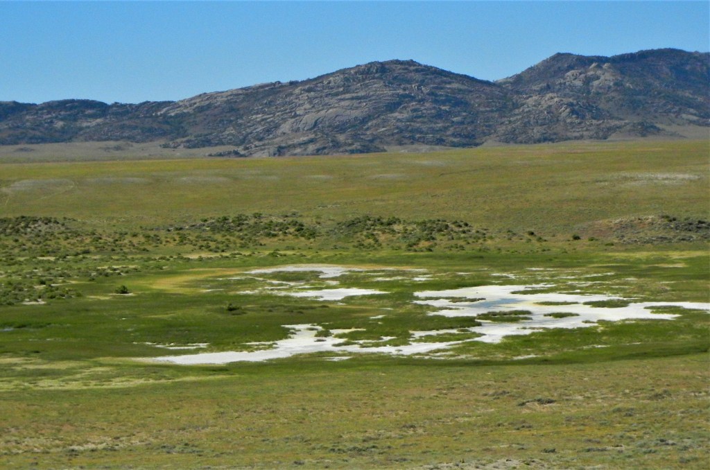
Saturday, 26th. Travelled about 18 miles, and missing our road, encamped on the North fork. At noon we passed the best grass I had seen since I left the frontier of Missouri; it was like a meadow, kind of blue grass — found buffalo, killed three.
I took this photo in Wyoming, but I don’t know what kind of grass it is. Looks good though!
I don’t know if this grass was buffalo grass, but it well may have been, since that was the predominant prairie grass. According to Native American Seed:
Buffalograss is interwoven into American history. Starting with fossil remnants found in Kansas dating back 7 million years ago. Buffalograss (Buchloe dactyloides) was and now once again is the principal forage grass for the American bison, hence the name. Early settlers made use of buffalograss for building their sod homes, while the longhorn cattle grazed it on their way up the Chisholm Trail. It is an important part of the short grass prairie ecosystem. For homeowners with conservation awareness, Buffalograss has become a recognized alternative for turf like lawns.
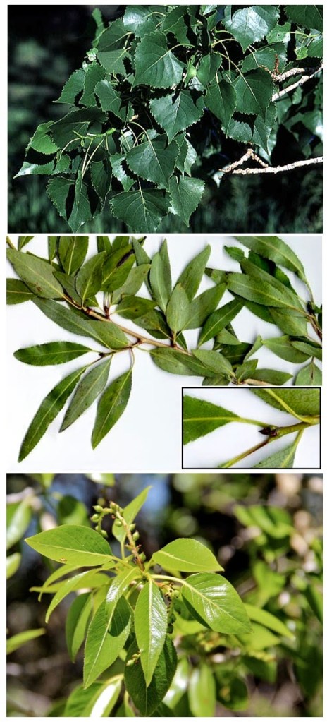
Friday, 25th. Journeyed over hills and dales — encamped on a stream affording plenty of grass, bitter cottonwood timber. It resembles the sweet cottonwood of Missouri, except the leaves are like those of the willow — distance 18 miles.
Cottonwood was useful as fuel, but it was also very important as forage for horses when snow was on the ground. You could keep your horses alive over the winter on cottonwood bark. However, horses would only eat the bark of sweet cottonwood, which they thrived on. Bitter cottonwood was shunned by horses.
For more information on bitter vs. sweet, read this blog entry from a Laramie-based botanist. That’s the source of these photos. Top to bottom: sweet cottonwood, bitter cottonwood, hybrid lance-leaf cottonwood.
Thursday, 24th. Left the Fort this morning and soon began to wind among the Black Hills. Two of our men stopped at the Fort (Simpson and Mast), but two other men with an Indian and his family joined us to travel to Green river.
Encamped having made about seventeen miles — hills here sandy — many wild pears, likewise an abundance of peas, wild — though the bush was dissimilar to to ours, yet the the pods bore an exact similarity, taste, the same.
These Black Hills are not the Black Hills of South Dakota, but the lesser known Black Hills of Wyoming, that rise west of the North Platte River (which the Bidwell-Bartleson Party is still following). Here’s a picture, with “Glauber Salts” in the foreground.
This entry raises the question “What could pioneers find to eat along the trail?” Bidwell mentions two wild plants here — wild pears and wild peas. James John, in his diary covering the same period, writes of “a kind of mountain turnip.”
What he called mountain turnip was prairie turnip, or timpsila, as the Lakota Sioux call it. It’s an edible tuber, Psoralea esculenta, that can be dried and stored. It was a staple food of the Plains Indian peoples.
Wednesday, June 23rd. Remained at the Fort; the things of Mr. Shotwell were sold at auction.
You remember poor Mr. Shotwell. I suppose what little money was realized by the sale of his effects went to buy supplies for the company.
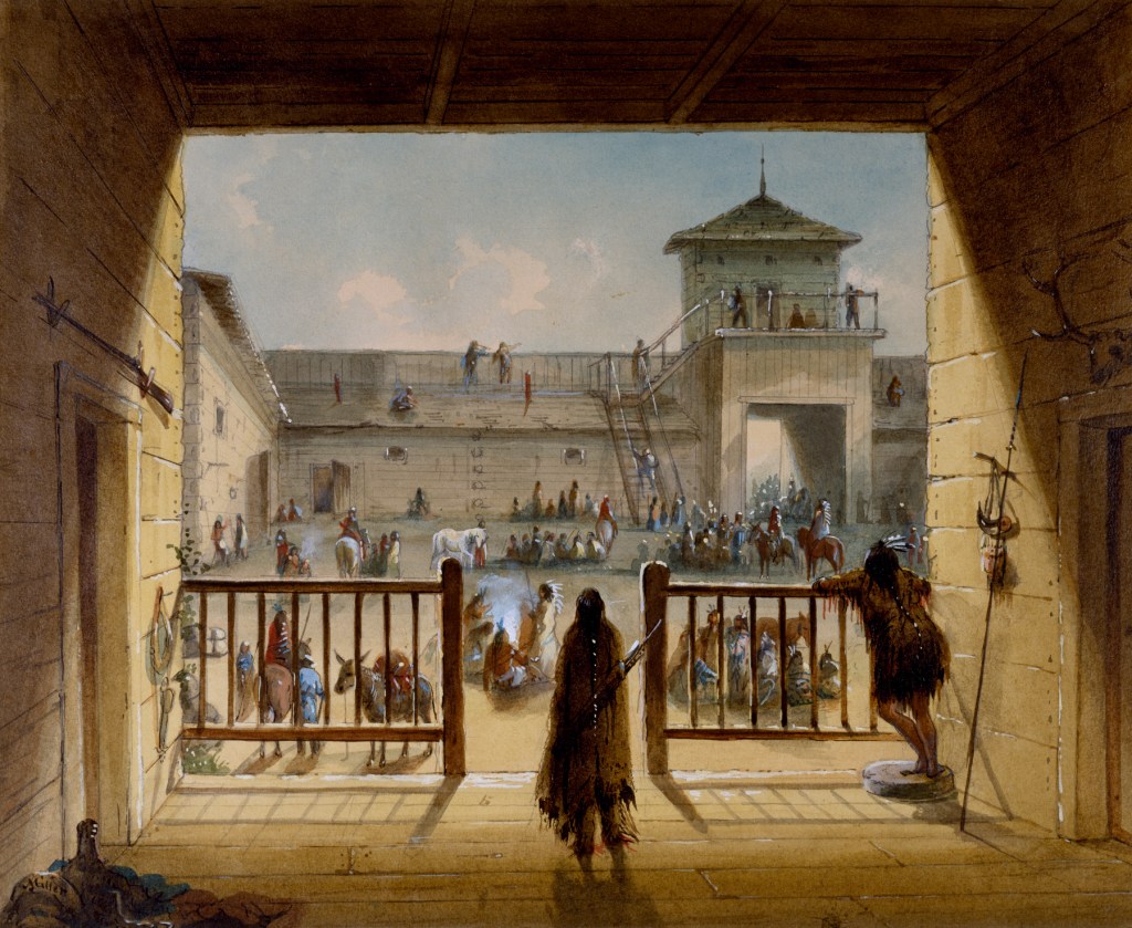
Interior of Fort John by Alfred Jacob Miller
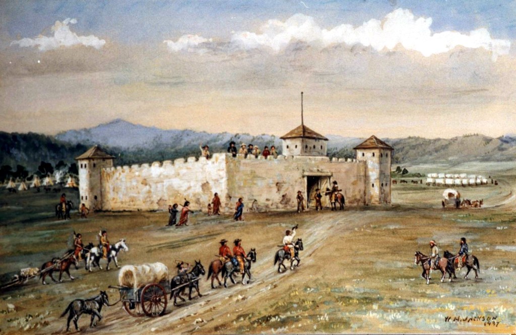
In 1849, as the pressure of emigration grew in the West, the U.S. government decided it needed a string of forts along the Oregon Trail to protect and assist emigrants. With the fur trade in decline, the American Fur Company was looking to get rid of the fort. For $4000 the army purchased the site, and began building barracks, stables, guard houses, and cookhouses. The adobe fort, although only eight years old, was dilapidated and infested with vermin. It was used as temporary shelter by the army, but was soon torn down and replaced.
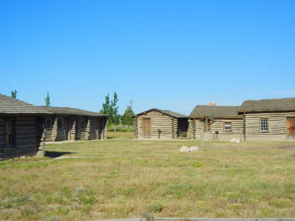
Today Fort Laramie is a national historic site and a number of the army post buildings have been reconstructed and restored. Nobody is sure exactly where Fort William and Fort John were located, but the best guess is that they were close to the river where the officers quarters are today.
Fort Laramie NHS is chock-full of history and well-worth a visit.
Tuesday, June 22nd. Eight miles this morning took us to Fort Larimie, which is on Larimie’s fork of Platte about 800 miles from the frontiers of Missouri. It is owned by the American Fur Company. There is another fort within a miles and a half of this place, belonging to an individual by the name of Lupton.
The Black Hills were now in view; a very noted peak, called the Black Hill mountain, was seen like a dark cloud on the western horizon. The country along Platte river is far from being fertile and is uncommonly destitute of timber. The earth continues, as we ascend, to become more strongly impregnated with Glauber Salts.
Bidwell didn’t have the spelling of Laramie right, but then, neither do we. The river is named after Jacques La Ramee, a French-Canadian fur trapper. The fort lay at the confluence of the Laramie River and the Platte in present-day Wyoming, and was the most important economic hub in the region.
The Laramie River
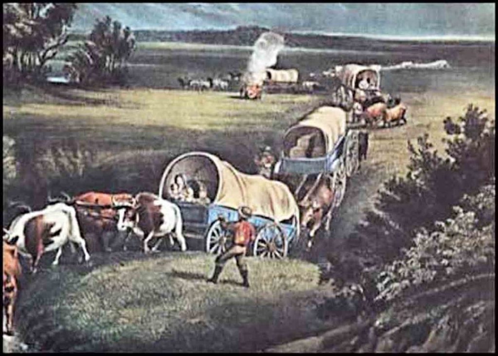
All emigrants on the trail were happy to get to Fort Laramie, and the Bidwell-Bartleson Party was no exception. Arrival at the fort meant that the journey was one-third completed. It was an opportunity to trade for needed goods, get travel advice, and send mail back to the States.
Fort Laramie, by William Henry Jackson
Over time, three forts had been built on this site. The first, called Fort William after its builders, fur traders William Sublette and William Anderson, was built of logs in 1834. The second, called Fort John after John B. Sarpy, an American Fur Company officer, was constructed in 1841 out of adobe bricks. Both were more commonly called Fort Laramie, and it was Fort John that John Bidwell saw when he arrived in June 1841, although it probably wasn’t complete.
Monday, 21st: We had an uncommonly good road today — an abundance of cottonwood timber — traveled late, having taken a stride of 27 miles.
Twenty-seven miles is a lot for one day. But the “road” (more like a trail) was good, the weather was pleasant, and the day was the longest of the year, so that they could “travel late.”
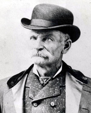
On this date — June 21 — in 1879 the notorious stage robber Black Bart held up a stage coach near Forbestown in Butte County. It was his first robbery in the year 1879 and would be followed by two robberies in October in Shasta County. He generally spent his winters in San Francisco, living off his ill-gotten gains of the previous summer and fall.
Charles Boles aka Black Bart
Bart continued to evade capture. In the last issue of the Weekly Butte Record for 1882, the paper reported that Black Bart was still on the loose.
Weekly Butte Record 30 December 1882
The editor has kindly put blanks where Bart wrote some rather coarse language. Editors were more sensitive to their readers fine sensibilities in 1882. I’m sure you can fill in the blanks.
Black Bart was finally captured and sent to San Quentin prison in November 1883. He disappeared from public notice after his release from prison in 1888. There is a theory (and a book) claiming that he spent the rest of his life as a druggist named Charles Wells in Marysville. If you want to read more about Black Bart, a good place to start is at http://www.blackbart.com/index.
Sunday, 20th. Passed through the Gap — came into an extensive plain, the beautiful scenery gradually receded from view — came to a creek called Horse — passed it, reached the river again — cool and windy — having come about 23 miles.
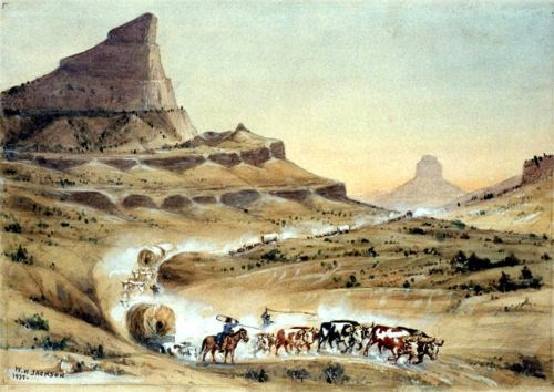
Here is William Henry Jackson’s depiction of coming “through the Gap” from the western side of Scott’s Bluff.
Scott’s Bluff, by William Henry Jackson. Courtesy of William Henry Jackson Collection, National Park Service
You can see Scott’s Bluff and Horse Creek on this map. They will soon be at Fort Laramie.
We gradually receded from the river in order to pass through a gap in a range of high hills called Scott’s Bluffs. As we advanced towards these hills, the scenery of the surrounding country became beautifully grand and picturesque–-they were worn in such a manner by the storms of unnumbered seasons that they really counterfeited the lofty spires, towering edifices, spacious domes, and in fine all the beautiful mansions of cities. We encamped among these envious objects having come about 20 miles.
Here we first found the mountain sheep; two were killed and brought to camp. These animals are so often described in almost every little School Book that it is unnecessary for me to describe them here.
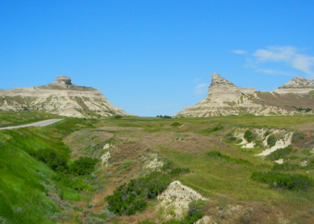
One day’s journey west of Chimney Rock the emigrants came to Scott’s Bluff, a rock formation named for Hiram Scott, a wounded fur trapper left behind to die by his companions in 1828. The fantastical shapes of the rocks were a welcome sight to travelers who had just spent weeks traversing the flatlands of the prairie.
Many travelers remarked on the fantastic forms taken by the steep-sided hills in this area of western Nebraska. More information about the history and geology of Scott’s Bluff can be found at the website for Scotts Bluff National Monument and the Oregon-California Trails Association.
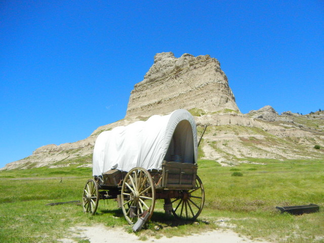
Here is what Scott’s Bluff looks like today. Much the same, except that the Bidwell-Bartleson Party had to negotiate deep ravines, like the ones in the foreground, rather than the smooth road you see on the left.