Devil’s Gate

Devil's Gate from the Independence Rock side. Photo from www.independencerock.org

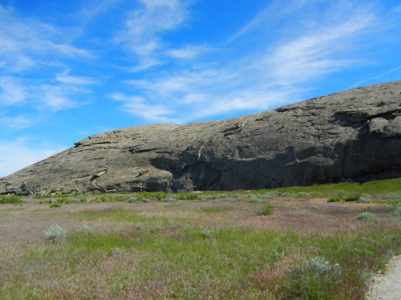
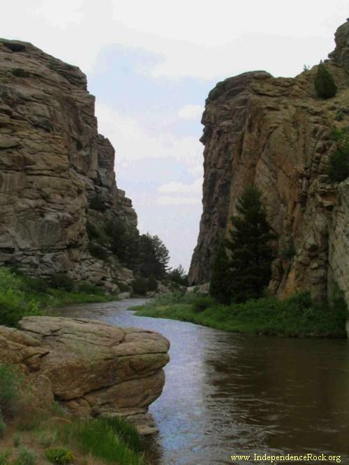
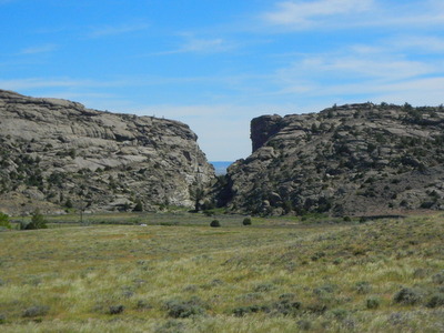
Devil’s Gate. Photo from http://www.independencerock.org

The Devil’s Gate is a picturesque feature a few miles south of Independence Rock. John Bidwell doesn’t mention it. He only says:

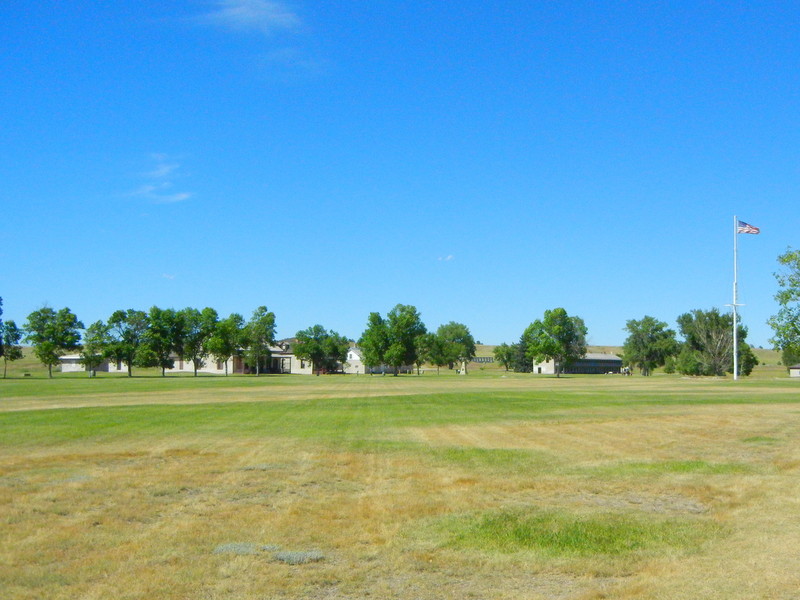
Tuesday, 6th. . . .  Went upstream about 8 miles and encamped on Sweet Water.

Which means they would have camped near Devil’s Gate. But it is impossible to get wagons through the narrow passage. Luckily just to the left is an easy way around the end of the rock formation.


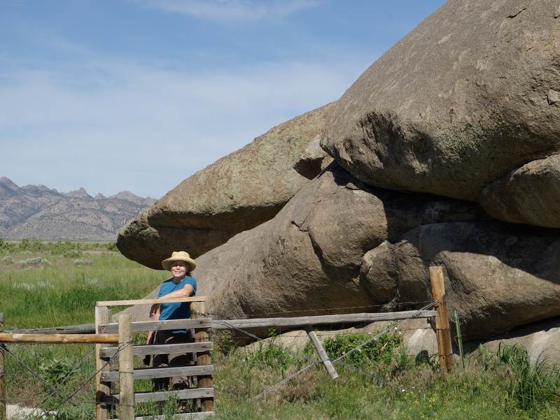
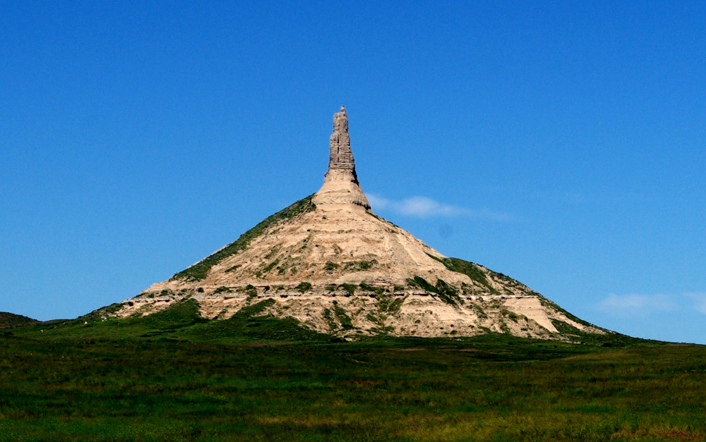
Wednesday, 7th. As we journeyed, the mountains were high and naked; passed a pond that was nearly dried up, perfectly white with Glauber Salts.

A bed of "Glauber salts" near Devil's Gate.

A bed of “Glauber salts” near Devil’s Gate.


Father DeSmet, in describing the Sweetwater River, says:

But suddenly changing its course, we see it or rather hear it rushing impetuously through a long cleft in a chain of mountains. These mountains, which harmonize well with the torrent, exhibit the most picturesque scenes; travelers have named this spot the Devil’s Entrance. In my opinion they should have rather named it Heaven’s Avenue, for if it resembles hell on account of the frightful disorder which frowns around it, it is still a mere passage, and should rather be compared to the way to heaven on account of the scene to which it leads.

I imagine Father DeSmet had the words of Jesus in Matthew 7:14 in mind: “Because strait is the gate, and narrow is the way that leadeth unto life, and few there be that find it.”

Travelers on the Oregon Trail often remarked on this unusual cut in the rock as they passed around it. Some would wade on foot or ride their horses through the Gate, just for the fun of it, while the wagons went around to the south.

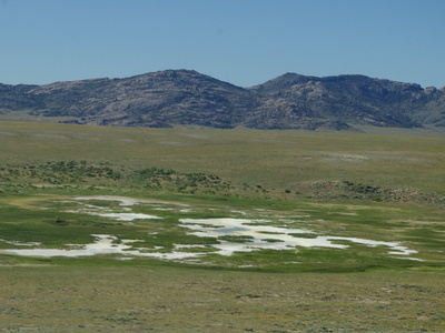
Today the Devil’s Gate is on private land. The LDS Church has a Visitor’s Center on the south side of the Gate. The Mormon Handcart Historic Site at Martin’s Cove commemorates the two pioneer handcart companies that were trapped here by bad weather in October and November 1856. An interpretive display just off the freeway tells the story of the Oregon Trail and the handcart companies.

Devil's Gate.

Devil’s Gate from the Martin’s Cove side.

Posted in Uncategorized | Leave a comment

Independence Rock

Independence Rock

Independence Rock

On July 5th John Bidwell wrote:

Monday, 5th. The hills continued to increase in height. After travelling 16 miles we encamped at a noted place called Independence Rock. This is a huge isolated rock covering an area, perhaps half a square mile, and rising in shape of an irregular obtuse mound to the height of 100 feet.

Father DeSmet wondered how the feature acquired such a “pompous name,” and thought it might be because of its isolated situation. But he was told that:

It was called so because the first travellers who thought of giving it a name, arrived at it on the very day when the people of the United States celebrate the anniversary of their emancipation from Great Britain.

As Bidwell wrote:

It took its name from the celebration of the 4th of July at this place by Capt. Wm. Sublette, and it now bears many names of the early travellers to these regions.

Sublette, fur trapper and mountain man, gave the rock its name in 1830, as he led 81 men and 10 wagons to the Wind River to hunt for furs and trade with the Indians. It became, as Father DeSmet called it, the “Great Register of the Desert,” as countless trappers, traders, emigrants, and missionaries carved or painted their names on the rock. IMGP4860

Today you can visit Independence Rock, walk the path around its base, even climb on it. (Watch out for mosquitoes–Wyoming mosquitoes are big and mean and I have the bites to prove it.) Hunt for names—the earliest I spotted was from 1890, but a careful search should turn up earlier ones. Many pioneers carved their names on the rock, but others only painted them with tar or grease, and those names have faded away.

IMGP4855Enjoy the adventure! (Mosquitoes and all.)

Posted in Uncategorized | Tagged | Leave a comment

On the Trail with John Bidwell and Friends

nance-chimneyrockWhen I wrote my book about John Bidwell in 2010, I had never seen the country he traversed on his journey from Missouri to California in 1841 (other than, of course, parts of California, where I live.) I got it all out of books. So I was delighted to finally have the opportunity to trace a part of the Oregon-California Trail and follow in the footsteps of the pioneers, if only for a little way.

I retired from my job as a librarian in April, and my husband retired in May. At last we weren’t limited to vacations of only a week or so! We planned a road trip to Wisconsin, where our son and his family live, with some time to see some of the sights along the way.

On our way home, after visiting Mt. Rushmore in South Dakota, we headed south to pick up the Oregon Trail at Chimney Rock. Interstate-80 more or less follows the Platte River and the trail of the pioneers, so driving along I-80 took us to Chimney Rock, Scotts Bluff, Fort Laramie, Register Cliff and northwest along the Platte River to Caspar, Wyoming, where we (and the pioneers) finally turned southwest with the river to Independence Rock.

It was enormously useful and enjoyable to see at last what this western landscape looks like, and to get a sense of the distance, the weather, the hardships of the trail. In our car it only took a few hours to travel the distance that the Bidwell-Bartleson Party spent twelve days traveling. 70 miles an hour for us versus 18-20 miles a day for them. (That was very good time for ox-drawn wagons on the open prairie, and the maximum that ox teams could be expected to do.)

But when we got out of the car, felt the sun and the wind, and looked out over the long stretches of sand and gravel, sagebrush and grass, with the enormous blue sky overhead, we could get an inkling of what it felt like to slowly walk on, mile after mile, wondering and worrying just how far was it to California.


Posted in Uncategorized | 1 Comment

Death on the Trail

Wednesday, June 23rd. Remained at the Fort; the things of Mr. Shotwell were sold at auction.

George Shotwell was the only casualty out of the 61 members who set out with the Bidwell-Bartleson Party. His death occurred about a week before the arrival at Fort Laramie.

Sunday, 13th. A mournful accident occurred in camp this morning–a young man by the name of Shotwell while in the act of taking a gun out of the wagon, drew it with the muzzle toward him in such a manner that it went off and shot him near the heart. He lived about an hour and died in the full possession of his senses.

These kind of accidents were not uncommon on the westward journey. Remarkably, and in spite of the dangers and deprivations faced by the Bidwell-Bartleson Party during their six-month journey, there were no more deaths. Later pioneers would experience a much higher death rate as disease and accidents took their toll. With heavy traffic on the plains and poor sanitation, cholera became a serious threat and about one in ten emigrants died on the trail.

The company buried Mr. Shotwell “in the most decent manner our circumstances would admit of,” and the Reverend Mr. Joseph Williams preached a funeral sermon. The sixty-four year old Mr. Williams was a Methodist minister and the oldest member of the Bidwell-Bartleson Party.

A young man by the name of Shotwell, shot himself accidentally and died about two hours afterwards. I was called upon by his comrades to preach his funeral, which I did. The death of this young man caused some seriousness in his comrades for a few days.

Of Fort Laramie, the Rev. Williams wrote:

We passed an old fort below the mouth of the Laramee River; and crossing that river we went up to a new fort that they were building, called Fort Johns. Here is a mixture of people; some white, some half-breeds, some French. Here is plenty of talk about their damnation, but none about their salvation.

The “damnation” he refers to is swearing and cussing. Mr. Williams frequently complained about the “dreadful oaths” of some of the men, and exclaimed “O the wickedness of the wicked!”


Posted in Oregon Trail, Shotwell | Leave a comment

Fort Laramie

Fort Laramie, by William Henry Jackson

Fort Laramie, by William Henry Jackson

Tuesday, June 22nd. Eight miles this morning took us to Fort Larimie, which is on Larimie’s fork of Platte about 800 miles from the frontiers of Missouri. It is owned by the American Fur Company. . . . The Black Hills were now in view; a very noted peak, called the Black Hill mountain, was seen like a dark cloud on the western horizon. The country along Platte river is far from being fertile and is uncommonly destitute of timber.

Wednesday, June 23rd. Remained at the Fort; the things of Mr. Shotwell were sold at auction.

More about the unfortunate Mr. Shotwell some other time. Bidwell didn’t have the spelling of Laramie right, but then, neither do we. The river is named after Jacques La Ramee, a French-Canadian fur trapper. The fort lay at the confluence of the Laramie River and the Platte in present-day Wyoming, and was the most important economic hub in the region.

The Laramie River

The Laramie River

All emigrants on the trail were happy to get to Fort Laramie, and the Bidwell-Bartleson Party was no exception. Arrival at the fort meant that the journey was one-third completed. It was an opportunity to trade for needed goods, get travel advice, and send mail back to the States.

fort laramie interior

Interior of Fort John by Alfred Jacob Miller

There were actually three forts on this site. The first, called Fort William after its builders, fur traders William Sublette and William Anderson, was built of logs in 1834. The second, called Fort John after John B. Sarpy, an American Fur Company officer, was constructed in 1841 out of adobe bricks. Both were more commonly called Fort Laramie, and it was Fort John that John Bidwell saw when he arrived in June 1841, although it probably wasn’t complete.

In 1849, as the pressure of emigration grew in the West, the U.S. government decided it needed a string of forts along the Oregon Trail to protect and assist emigrants. With the fur trade in decline, the American Fur Company was looking to get rid of the fort. For $4000 the army purchased the site, and began building barracks, stables, guard houses, and cookhouses. The adobe fort, although only eight years old, was dilapidated and infested with vermin. It was used as temporary shelter by the army, but was soon torn down and replaced.

Parade ground and buildings at Fort Laramie.

Parade ground and buildings at Fort Laramie.

Today Fort Laramie is a national historic site and a number of the army post buildings have been reconstructed and restored. Nobody is sure exactly where Fort William and Fort John were located, but the best guess is that they were close to the river where the officers quarters are today.

june2014 401Fort Laramie NHS is chock-full of history and well-worth a visit.

Posted in Uncategorized | Leave a comment

Scott’s Bluff, part 2

scottsbluff-1As the Bidwell-Bartleson Party approached Scott’s Bluff, they faced a problem that they hadn’t encountered yet on their journey–a barrier. Pioneer companies followed rivers, but they didn’t cross them any more than they had to, because crossing a river was a difficult and dangerous undertaking. They had been following the Platte River, but now the river ran right under the bluffs.

So with Scott’s Bluff before them, they had three choices: cross the river and see if traveling was better on the other side, go around the short range of hills on the south (now known as the Wildcat Hills), or head straight for the gap. The Gap seems to be the obvious choice, but when I spoke to a ranger at Scotts Bluff National Monument, he told me that getting through the Gap was too difficult and wagon trains before 1851 were forced to go the long way around the hills.

In 1851 the U. S. Army built the road through Mitchell Gap, making it passable for wagon trains. If you look at the photo above you will see the highway that follows that road today, but you will also see the ravines that made traveling through the Gap so arduous.

But Bidwell says nothing about going around. They camped among these “grand and picturesque” hills on June 19th, and on the 20th they made their passage. He writes:

Sunday, 20th. Passed through the Gap–came into an extensive plain, the beautiful scenery gradually receded from view–came to a creek called Horse–passed it, reached the river again–cool and windy–having come about 23 miles.

They took those hills in stride and carried on, making good time.

Posted in Oregon Trail | Leave a comment

Scott’s Bluff

Scott's Bluff

Scott’s Bluff

One day’s journey west of Chimney Rock the emigrants came to Scott’s Bluff, a rock formation named for Hiram Scott, a wounded fur trapper left behind to die by his companions in 1828. The fantastical shapes of the rocks were a welcome sight to travelers who had just spent weeks traversing the flatlands of the prairie. John Bidwell wrote:

We gradually receded from the river in order to pass through a gap in a range of high hills called Scott’s Bluffs. As we advanced towards these hills, the scenery of the surrounding country became beautifully grand and picturesque–they were worn in such a manner by the storms of unnumbered seasons that they really counterfeited the lofty spires, towering edifices, spacious domes, and in fine all the beautiful mansions of cities. We encamped among these envious objects having come about 20 miles.

The Platte River runs along the northern base of the bluff. On my visit to Scott’s Bluff National Monument I wondered why the pioneers had to find a way through the rock formations of Scott’s Bluff. They were following the river–why didn’t they cross it (it looks narrow and mild-mannered at this point) and travel along the flatter land on the other side?

I talked to the ranger about it, and he told me that the Platte is now controlled and doled out for irrigation, but back in the day it was wide and treacherous. Pioneers didn’t want to cross it if they could avoid doing so. Moreover, the land on the other side, which today is developed, was actually criss-crossed with ravines that made it difficult to navigate. So travelers stayed on the southern side and negotiated the bluffs and hills instead.

Tomorrow’s question: Where did the Bidwell-Bartleson Party cross Scott’s Bluff?

DSCN2880


Posted in Uncategorized | Leave a comment

Bidwell at Chimney Rock

needle1In 1841 John Bidwell was traveling across the “dull and monotonous” Great Plains when finally the landscape began to change. On June 17th the party spotted castle-like Courthouse Rock, and on the 18th they came to Chimney Rock, a landmark mentioned by nearly every emigrant who left a record:

Friday 18th: At about 12 o’clock today we passed another object, still more singular and interesting. It is called by the mountaineers the Chimney, from its resemblance to that object, and is composed of clay and sand so compact as to possess the hardness of rock. It has been formed from a high isolated mound which, being washed on every side by the rains and snows of ages, has been worn down till nothing is left but the centre which stands upon an obtuse cone, and is seen towering like a huge column at the distance of 30 miles.

Most of the company members traveled from their campsite to Chimney Rock to get a closer view and to inscribe their names with tar and grease. No doubt the names have long since worn away. Bidwell later noted that the chimney had become shorter than when he first saw it and less square. Today it looks more like a spire, but in 1841 it really did look like a chimney. Or maybe, as Father DeSmet said, a funnel.

Father Jean Pierre De Smet, the missionary whose group traveled along with the Bidwell-Bartleson Party, wrote of seeing “the chimney”:

It is called so on account of its extraordinary form; but instead of applying to it an appellation which is rather unworthy this wonder of nature, just because it bears some resemblance to the object after which it is named, it would have been more proper to call it “the inverted funnel” as there is no object which it resembles more. What excites our astonishment, is the manner in which this remnant of a mountain,composed of sand and clay, has been so shaped, and how it has for such a length of time preserved this form, in spite of the winds which are so violent in these parts.

And if you have ever traveled through Nebraska, you too can attest to the “violence” of the winds.

Posted in Oregon Trail | Leave a comment

On the Trail with John Bidwell

buffalo-1-2I am on vacation in the Great American West and starting tomorrow I’ll be following in the footsteps of John Bidwell and countless other pioneers who trekked across the Plains. I saw these bison near the road today; here is what Bidwell had to say about the buffalo he saw in 1841:

Tuesday, June 8th: There were 8 or 10 buffalo killed today,but not one-tenth of the meat was used; the rest was left to waste upon the prairie. In the afternoon we passed the confluence of the N. & S. forks of Platte river and encamped, having come about 18 miles; many hundreds of buffalo were seen at this place.

The scenery of the country on the Platte is rather dull and monotonous [sorry Nebraska], but there are some objects which must ever attract the attention of the observant traveler; I mean the immense quantity of buffalo bones, which are everywhere strewed with great profusion, so that the valley, throughout its whole length and breadth is nothing but one complete slaughter yard where the noble animals used to graze, ruminate, and multiply in uncounted thousands–but they are fast diminishing. If they continue to decrease in the same ratio that they have for the past 15 or 20 years, they will ere long become totally extinct.

The Indians are anxious to preserve them, and it is said of them that they never kill as long as they have any meat remaining, but behold with indignation the shameful and outrageous prodigality of the whites, who slaughter thousands merely for their robes and leave the meat, which is far more delicious than that of tame cattle, to waste, or be eaten by wolves and vultures.

Tomorrow we will join up with the Oregon-California-Mormon Trail and I’ll give you more reports from along the way.

Posted in buffalo, Oregon Trail | Leave a comment

Happening this Weekend

There’s a lot going on the weekend of May 10-11, with events for every interest and taste, all in beautiful Butte County. Here are two of them:

Feather Fiesta Days is the big event in Oroville. The Butte County Historical Society is taking part by hosting Conversations With Local Authors at the Ehmann Home from noon to 3 p.m. Looking for a book on local history and travel? Find it in the gift shop and get it signed by the author, or just enjoy chatting with local researchers about their areas of interest. The books include titles covering several Butte County towns, Oroville Dam, Oroville-Quincy Highway, the poet Pres Longley, John Bidwell, flumes and hiking trails, a logging mill, and other topics of local interest.

I’ll be signing my books on John Bidwell and Pres Longley. I’d love to meet you! Drop in anytime during the open house to chat. Refreshments will be served.

Museums all around Butte County have joined together to host the first ever Chico Area Museum Alliance Museum Hop. Start at the museum of your choice, get a passport, and visit as many as you can on Saturday and Sunday, May 10-11. Your name will be placed in the prize drawing. Participating museums are: Bidwell Mansion State Historic Park, Chico Creek Nature Center, Chico Museum, Colman Museum, Gateway Science Museum, Janet Turner Print Museum, Museum of Northern California Art, Patrick Ranch Museum, Stansbury House, and Valene L. Smith Museum of Anthropology.


Posted in Uncategorized | Leave a comment